20141218 Half Crazy, Half Lazy


The official first day of vacation is never meant to be relaxing or vacation-like, etc…most of the time it’s spent catching up, be it on sleep or administrative duties (hitting the bank, renewing leases, emptying the litter box, etc) or gleaning contacts on deserted, windswept mountain tops. Today was a day to make it count, like Tuesday, when the formerly closed trails have finally been reopened, well, today was my chance to pay a visit to both HL/JB-017 Unjangsan and HL/JB-020 Gomjigisan. Uh-huh. Another double activation (8+3)+(8+3) and one that I haven’t done since 2012. I’ve been waiting…
When I went down to the car at four o’clock, I wasn’t too concerned–yes, it’d be chilly (chillier, with that nice, sparkling, clear sky) but it is almost technically winter. Isn’t that what it’s been like these days? Having arrived at the trailhead located at Naecheo Village (not at Piam Pass, this time), a local bus arrived a few minutes later: quick jumped out to ask him about the schedule, as I’d like to do something more like a through hike at some point, JB-020 –> -017 –> 027 but getting back to the car would pose a slight challenge, unless I feel I’d be lucky in getting a call taxi to come out. The bus doesn’t go in my direction of interest, but could always be a possibility later on (or going east over Gubongsan…which will become a SOTA mountain with the next update!).
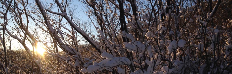
So, I finally get all organized, shoes and spikes on, just as it’s barely starting to get light out when I start up the trail–I’m leaving fresh prints, but that’s to be expected. All is fine and dandy, though as I ascend closer to the ridge (which runs on a north-south axis) I can hear the wind, which I think has actually started up because the sun has risen (energy input into the system). Reaching the junction on the ridge proves me right: yep, wind. No problem, winter, right? It would seem as if the drifts of the other day were a simple appetizer, just a smidgeon of the main course to come…
My main source of surprise comes from the fact that HL/JB-017 Unjangsan is a fairly popular mountain, receiving busloads (really!) of hikers coming to make the loop (which doesn’t get closed off during fire season these days) that culminates between Dongbong (Samjangbong), Unjangdae and Seobong (Chilseongdae). However, the trail did not seem very broken in, at all. Even to the point where I had to break trail in parallel, off to the side of the main path, because of the drifts. The drifts are in the areas sheltered by the wind (hence the snow gets deposited there) and was shallow, guess where? On the windy upslopes a few meters west of the ridge’s crest! We’s gots cold and numbness here in the ROK, but I haven’t thought of frostbite in years, possibly decades. In order to facilitate the ascent, I had to remain exposed to the wind–not fun. Then there are those stretches where you don’t really have the choice but to stay atop the ridge (nice drops on both sides) and face the drifts. Ah, the drifts. Did I mention there were snow drifts? There’s a first time for everything and this is the first time I’ve wished I had snowshoes in Korea: trying to advance, uphill, and breaking through chest-high banks of powder. Seriously? I don’t think there had been more than 15cm of actual snow that landed on the ground, but now it was all right here.

Irgendwie, finally arriving at the summit just a bit after nine, I didn’t wish to fool around and lose the heat I had been generating plowing up the hill (for what seemed ages, but around two hours for the ascent isn’t /that/ bad…it’s quoted at an hour for that trail, can take one and a half loaded down with gear, so I’ll take that given the conditions), so I quickly set up the antenna (5s collinear, as per our “nail-it theme” this month) and set up shack sweet shack in the bothy bag. The actual activation itself wasn’t very punishable, having been completed within a half an hour–quite smooth for a weekday morning.

Despite stunning views in all directions, today would not be a day to dilly-dally up in the activation zone, especially were I to stick to my original plan of activating two summits. I have to say that during the activation, my mind was leaning more and more towards not doing JB-020, but was open to checking it out as far as descending via Kalk Pass–however some of my antenna segments had gotten stuck in the tree while dismantling and sortof cemented the thought that a second activation would not be possible today. That, however, did not stop me from still taking that route (breaking trail should be easier going downhill, no?) plus it should be a bit more out of the wind…

바보…I should know better, as it isn’t all descent, but those places it wasn’t that bad, just a newly developed hole in the side of my shoes was beginning to make itself apparent breaking the banks. Then some uphill through the snow, then down again, until the pass…eh…Gomjigi? Nope, this bear was not going to be crossing that mountain today–I came down a better trail, I’m not going up that path. Down the access road it is!
Five minutes later I am thawed out enough that the thought crosses my mind “maybe I can do it today.” That’s a 400 meter elevation difference talking there–the weather hasn’t changed up there. Besides, my shoes were sloshing around, now that everything had melted. That wouldn’t be a good idea. Moving along, people. Going down this road with its many switchbacks is actually longer, but more comfortable. At one of the curves, I had the impulse to look up–what did I see? The very same ribbon I strung up three years ago marking the end of the shortcut between Naecheo Village and this road (because to follow this road all the way to the bottom, a bit to the east and then back up again to the main trail head and parking lot would add an additional 1.5 km or so). No joke!
Twenty minutes later and I was back down at the parking lot, still the only car there, so I assume the only client of the day for Unjangsan. Not before rustling up a doe just above the farms…

Tuesday Gyeonggaksan


Always love it how people start freaking out when it starts snowing, but it seems to be when it’s too late to actually take some action (despite a bit of snow now and then, haven’t seen a snow day around here…I figure it’s a byproduct of schools conveniently being located within walking distance–for the students, at least). Just the other day my co-teacher came rushing into the classroom at 4:22 PM, to tell me that I could leave early due to the inclement weather. Really. Backstory: my last class at that school finishes at 12:20 and I have free time all afternoon until the sun sets and I am released 4:30 PM when I may go join the hordes of other mindless labourers who all due to any lack of coordination must congest the roads in unison to ensure a punishable return home.
눈오기 시작하면 여기있는 분들 행동 이상하진다–해마다 겨울 오겠잖아요…왜 준비를 안 해요? 눈이 많이오면 학교이나 다른 행사 취소한경유 아직 못 봤어요. 다른 날에 나의 팀강사는 오후 4시22분에 교실에 빨리 들러왔어요: “쌤! 날씨가 나빠져서 오늘은 우린 일찍 퇴근 할 수 있어요!” 정말. 있잖아요…나의 마지막 수업을 12시20분에 끝나고 4시반까지 오후동안 계속 자유시간 있어요. 진짜?
Focus people! Logic dictates that increased levels of sublimated precipitation would be found to my south thus that is the direction of travel which I must pursue. It could also be the fact that it is December sixteenth and all of the trails which had been banned from entry during the last two months would finally be open again–with the gates open, I whole-heartedly rushed into the heart of the storm, splashing nimrods cruising at 20km in their all-season tired non-lit white SUVs with slush as I exerted my full on Pride™ power: 1300cc and 50W on 2m. Three hundred meters up at the Fire Pass, I pulled over and parked at my usual spot.
집중! 물론 남쪽에 더추우면 날씨더 나쁘면 난 반드시 그 방향으로 이동 해야돼요. 혹시도 오늘은 12월 16일이니까 거의 2개월동안 통제되는 산책길들 이젠 열린다–가슴 기쁘고 폭풍으로 들러가서 여름타이어신은 저속 SUV를 추월하고 프라이드™ 파워 300미터 불재까지 편안하게 도착해서 보통위치에서 주차했어요. 스노우타이어도 도워 줬어요 ㅎ

Breezy and snowy would be a fitting description of the conditions as I followed a single pair of footsteps going up the hill…until I reached the top of the western ridge. Let’s just say there weren’t any paragliders today catching some ridge lift… Had I not known the trail by heart, that there was shelter up on top (and have someone else ahead of me somewhere uphill) I’d seriously question why I was up there. Eh, the answer is simple: points is points. I was fully warmed up but couldn’t take off my windbreaker because it was so blustery! There were some drifts already formed, but it wasn’t whiteout conditions or anything, either. Besides, there aren’t any alternative routes on this trail, it’s straight or straight down.
산행을 출발 해서 발자국 1개 딸라서 날씨가 통퐁이 되고 눈이 계속 내려오고 있었어요…서쪽의 능선까지. 거기서 바람 많이 불렀어요! 오늘 능선 리프트 타는 파라그라이더 볼 수 없겠다~ 정말, 이 산길을 안 외우고 위에 대피가 없으면 (그리고 앞에서 어디서 한분이 있고) 정신을 확인 해야겠어요. 암튼 점수는 점수에요. 몸이 참 따뜻했는데 바람 (태풍?) 때문에 바람막이 바찔 수 없었어요! 눈더미가 여기 저기 있었는데 아직도 잘 볼 수 있고 그길에서 다른 길 선택이 없어요.
Upon finally reaching the peak with the fire tower, I left the prints to continue on their merry little way without me (doing the loop course?) while I set up the 5s antenna and retreated from the wind to activate. The last few activations haven’t been that difficult to achieve, QSO rate wise–well today was going to turn that around: it took forever and a half to obtain four contacts, all basically local, with excellent signals.
산불감시초소탑에서 발자는 날없이 계속걸려서 (둘레 코스한다?) 5단지피 설치하고 탑속으로 가서 운용을 했어요. 요즘 저번 몇 운용이 합격하기 그렇게 힘들지않지만 오늘은 진짜 어려워서 QSO 4건밖에 못 잡아서 모두가 그냥 강한 지방 신호들 됐어요.
The descent sloughing through the drifts in the dark was quite pleasant, only catching a few new sets of tracks, some rabbit, some deer, nothing bigger this time around, reaching the car at just a little after seven o’clock. The roads weren’t so bad on the way back that I did arrive at diner’s club on time–what was interesting was that south of the Mangyeong River had the worst of the road conditions but on the other side things were very clear (until getting downtown again, that’s another story).
18시10분에 정리하고 우리 우더운 눈길로 하산을 행복했어요–토끼와 사슴보다 이번엔 더큰 발자를 (인간제외) 보지 않고 19시 좀넘어서 자동차에 도착 했어요. 길거리 월성봉갈때보다 좀 더 좋아서 완주군과 김제에 좀 미끄럽지만 만경강을 지나서 갑자기 도로는 깨끗했어요! 와! 시내까지…ㅎㅎ 그렇지만 화요일마다 만남 다이너스 클럽에 늦게 도착 하지 않았어요!
Better luck, this time!

Some in the audience may recall an expedition a few years back to Wibong Mountain Fortress. Or maybe not. Ahem. It was sortof a flop. Kinda. Maybe. Eh…on that occasion I managed to muster up only three contacts, despite having lugged up the FT-857, set up a Zepp,…in the end, the contacts mustered were via 2M on an HT…foo foo.
몇년전에 위봉산성에서 실패된 운용을 아마 어떤분은 기억 할 수 있읍니까? 기억도 안하면 ㅇㅋ…그때에 운용 해봤는데 교신을 3건만 합격 했어요–4개 아니구 ㅠㅠ 또는 난 나의 큰 리그와 단파 안탠나까지 가지고 갔어요: 그리고 그 3 QSO가 다 2미터 HT로 했어요….땡.
Fast forward a few years, time is fluid, no? to redeem myself, having avoided it for a while (“well, officer, the trail isn’t that discernible….also, no summit marker, that I’ve been able to find”)….errr…do such things matter? She’s got prominence! That’s what matters–ignoring the fully remodeled with tended grounds hump across the street, in black and white, this is what counts!
몇년 앞으로 보시면 오늘오후에 완주군으로 이전쟁 맞자워야되었어요…요즘은 지도보면서 그산을 그냥 보기 싫었어요. ㅎ. 이름도 찾을 수없어서 생각 안했어요 (정상에서 아무표가 없고 많은 지도탐색 하면서 못 봤어요–하지만 좀 옆으로 때때로 귀뜰봉 찍었어요, 601미터봉대신 580미터해발 에서.)
이젠 그냥 “위봉산성”으로 이라고 할꺼요–산성벽이 저기까지 올라간다. 미안 하지만 JB-080 서래봉 때문에 맞은편 (북쪽에) 위봉산은 소타된 산 안이에요. 아마 더 이쁜데 그것때문에 위봉산 아직 방문 하지 않았어요. 남쪽있는 산성 그렇게 잘 관리와 리모델링 할 수 있으면 좋갰다!
Previously, I had ascended up the easterly ridge, leading up to the summit from the pass where Wibong’s fortress walls cross, however since it was hairy business going up, I said to myself, “self, the trail goes down over here,” and descended along the non-renovated fortress wall all the way back to the pass. Wasn’t glamorous but it was cleared. This time I went up this route, and with the snow and whatnot, it wasn’t that bad climbing–I just established that I would not be going down via that same route this evening….
저번에 난 동쪽능선으로 알라 갔어요…산책길상태 좋지 않았어요, 그래서 정상에 반대편의 산성별으로 내려는길을 봐서 하산 선택 했어요. 이번 여기로 올라 갔어요. ㅇㅋ. 노프롭램 하지만 오늘은 이도같은 길로 하산 원하기 싫었어요…아직 너무 미끄럽고 걸려면서 벽돌이 계속 움지겼어요.
Upon reaching the summit, I was rewarded with quite a nice view, even if soon after the sun had decided on going behind the one cloud that was in the sky…I mean, c’mon. Really? With hope that this was not a premonition of a repeat performance for this summit, I proceeded to setup my big 5s 2m antenna (eh–it’s served me well so far, this week?).
정상에 도착 해서 멀리까지 이쁜 배경을 찾았다! 몇분 못 지내서 햇볏이 없으졌어요…하늘에 구름 하나만 있었는데 그 구름 하나 해와 위봉사이에 멈쳐서 주차했다. 정말? 양쪽에 모든 다른산들 햇살을 받고있었어요….불운 신호 이라고해…? 아니! 그냥 따뜻한 날씨없는 듯이에요–그럼 5단지파 설치 준비 했어요. (이번주간 동안 잘 썼어요…오늘도~)
Not so fast–there! The wire between the J-pole matching section and the first phased segment broke–well, it is a weaker point in the design, where probably the most stress is exerted when the wind blows (and it does, on those summits!) and things, they all start a’floppin’ around! No, wait! That’s not it–the connection between the two elements (the bottom of the “J,” if you will) had disappeared, donc a bit of surgery was necessary…I removed some wire from the first segment to make the matched connection…if there were any discussion before regarding how much out of tune this antenna was, well, I think we may say in confidence that is more out of tune than beforehand…
앗! 그렇게 쉽게 안돼! 제이폴 매칭아래에 연결선 좀 빠졌어요? 빠리빠리 수슬 해야지–공구 있음…첫단에서 선을 조금만 빌렸어요. 얘전에 튜닝 걱정 있었어요–이젠 더 확실히 걱정 하도 돼요! ㅎ
Such trivialities didn’t hold me back from activating, even if there was a lull midpoint–success was to be had! Yes, it was getting dark, though people do get out of work and hop into their autos for the schlepp homewards….all I have to do it suck it up, call CQ, and wait around.
그런 작은 문제도 있으면 아직도 합격 해야돼요–다른 선택없음. 만약에 주파수 좀 조용이 하면 그냥 기다릴 수 있고 퇴근시간에 모바일국들 나오갰다.
Remember that comment before about not descending along the non-wall (could be called as such?)–well, I decided upon leaving the summit via the east ridge (not the east ridge which leads to JB-070, but the other east ridge, obviously!), through the mini-bamboo…following the trail was actually easy enough, but somewhere along the way down I must’ve gotten distracted, as I was, pretty soon, going over fallen trees and whatnot…I can only assume from 2012’s typhoon: Vol-au-vent (I know, that’s not the real name, but it sounds as such, and I’m too lazy to look up the name at the moment of press–another time! Peu importe, y’all can figure it out….). For a stint. I was crashing over and under fallen trees, snow-smushed mini-bamboo, usw, until reaching the logging road. Skid. Whoops!
아까 전에 나온 다르게 하고 싶은 하산길 댓글 기억 하시죠? 저쪽 동쪽능선으로 (JB-070 원등산으로 가는 능선 말고…) 하산 했어요. 반길까지 편리하게 가는데 2012년 가을의 태풍 (바로밴)
Lost an Eisen: one for the mountain….I ain’t going back to look for it tonight. Maybe in the spring? I know, there’s plenty of moonlight to spare, but I’m happy to be back on pavement, at the moment.
Yes, of course, I did have auxiliary lighting, but why spoil the mood? Nothing like the moonlight on the snow during a northwards trajectory, be it on foot or bike.
On a side note, I was stuck behind a Musso Sports with military plates (육) on the way back…until Bongdong, at least. Was interesting: usually you see the all-band radio-tuned antennas only on the older heavy-duty vehicles–I’m not current, but it seems like they’d be changing their fleet over?
Out with the old, in with the cold!


Yesterday, December 1, definitely truly proved itself to be the beginning of the winter bonus period in Korea, with a good snowing…even with some starting to stick! Might have to put the wheels away for the winter? Even yesterday’s tea, which had been left behind in the car, had frozen–the change from a very comfortable autumn to “it’s officially winter” was a rather sudden one! What better way to commemorate than with an after-school activation on one of Iksan’s higher peaks, HL/JB-140 Cheonhosan? Registering at exactly 500mASL it just squeaks its way into 2 points and winter bonus territory. Time to cash in, while the daylight lasts~
어젠 12월 01일의 겨울 보너스점수 기간 찐짜 맞으게 시작 했읍니다: 눈이 왔다~! 해마다 날씨가 다르지만 올해 가울이 착했는데….새로운 달이고 새로운 계절은 시작하고 딱 쉬치처럼 이추운것 꼈어요! ㅎ
자동차안에 넣은 차잔까지 얼었다~
월요일의 엄무좀 늦게끝나서 오늘은 이겨울기간시작 기념 해야했어요–익산지역에 HL/JB-140 천호산밖에 다른 맞는목적지 생각 나지않았어요…그럼, 가자!

So, class was finishing up in Nangsan, at the northern end of Iksan, so I could easily cruise on over to Yeosan, up the hill and over the pass that is often snowed out so much that you have to park on one side and walk up the road through the brand-new two-lane tunnel which passes under the pass, and up a bit closer to the ridge line on the northern side of the hill.
낭산쪽에서 수업이 끝나서 바로 여산방향으로 쉽게 이동 했음…이 시골학교 시간표는 평일 소타운용에 편리하게되었어요!
여산 다운타운을 지나서 비봉쪽으로 가서 힘들지 않았다–저번방문 할때는 고개까지 도착못했다–타이어체인도 풑였는데 땡! 불 가능. ㅠㅠ
이젠 조금 낮게 새로운 턴널로 지납니다: 차로 2개 있고 급커브 20개 없고 그냥 쭈~욱! 반대편에 2분안에 도착 했어요!
Despite the frequent snows these last few days, it was actually possible to get up to about 300m with the car on the logging roads–even the parts that were in the shade.
거기서부터 천호산의 ‘노스 페이스’까지 임도로 300미터정도 차랑 올라 갈 수 있었음…눈도있고 그늘도 있는데 ㅇㅋ! (날씨 이렇게 계속하면 아마 담달 안 됨…)

To ensure that I wouldn’t be calling CQ for two hours on this hill on a weekday, I made sure to bring the trusty ol’ 5 segment collinear–despite not having toughened it up for regular use, it’s still holding on. Whether it remains in its original tuned condition is another issue–one I haven’t delved into recently…if I don’t measure it, it doesn’t exist, right?
평일오후에 HT로 2시간동안 씨큐 씨큐 불기 싫테니까 큰 5단지피 가지고 갔고 사용 했고 운용 빨리 빨리 했어요…혹시 이 안테나 상태가
안좋지만 튼튼하니까 계속 사용 하는중–나중에 (항상 나중에…뭐?) 다시 만들고 더 깨지지않는 모델 들어야돼요: 요즘의 튜닝 확인 안했지만 검사 안하면 문제상태 없잖아요 ^^

So, the activation was actually quite quick in the doing, and hands weren’t cold except when collapsing the antenna mast (gloves just don’t grip as well!)–thrice: once for taking some arial photos of the summit, once for resetting the antenna (love it when calling back after your first CQ that the antenna just comes crashing down) and finally to pack up and descend.
사실 준비 잘했으니까 이번 천호산 운용 빨리 완료 되었고 춥지 않은데 안테나 폴대 정리할때만 손이 시렸어요. 3 번. (1번째 “위성” 사진 몇장찍고 2번째 첫 응답 하면서 갑자기 안테나 고장나서 그냥 크래쉬로 내려왔고 3번째 진짜 하산준비 포장 했거든요~)
*그 위성사진들 나중에 붙이겠음….
Well, at least I was back at the vehicle, with daylight to spare! Not an easy feat, after school in the winter!
아무튼, 햍빛 넘어가면서 차에 도착했어요–물론 수업후에 겨울운용하면 이것은 쉽게 할수 없어요!

20120815 구성산
Rainy or not, the 815 contest is a day to be on the air in Korea. This year, not falling on a weekend or creating a longer-ish weekend, being right in the middle of the [work] week, my QTH wasn’t that much a ways a way. Kimje, in fact, via Jeonju, via Wanju. The roads do wind about. I made the effort to bring the 857, principally for the HF bands, including 7 MHz which should’ve been hot, but was not so. ㅠㅠ
Can’t say it was raining the whole time, but it did delay things a bit, and most of the operations took place inside the big red bothy bag. As a result of the WX, there weren’t many others seen on the trail. Fun was had, contacts were made, nothing was broken.
Mandeoksan from the west

You may remember last year when I mentioned how much of a ______ going up the east side to get to HL/JB-058 만덕산 was….sliding up shale, etc, etc….well, though I technically took the better trail up this time, I actually didn’t, having taken the wrong fork not very high up. The result of which was going through an open field trail infested with spiders (you know, by the time August hits, the mommas’ bellies full’o’babies are larger than your thumb), then another shale-y scramble up a deer trail, until finally hitting a decent ridgeline trail.
This time also, I took the 857 since it was a weekday….need the extra push, sometimes. It was worth it, getting some contacts farther out to the south and northeast. Getting up to the summit, it looked like someone had been doing some trimming up there, and signage needs a slight upgrade…. Using the 5s GP, quick work was made for the activation, it was after all, a school day, no time to fool around.

Descent was accomplished via the correct trail, which will be remembered for next time. Maybe next time will be fall or winter, when a machete wouldn’t be necessary…
HL/JB-027 샤티미 연셕샨!

The KMA does it again! The Tuesday morning hour-by-hour forecast had happy little suns all morning except for one hour when there was supposed to be a little rain. In fact, it was the exact opposite. At first it was sprinkling, but me, having checked the weather ahead of time, put off going up the trail until about 6:30. It was a constant drizzle until around the point on the map below where you see the track splitting off into a Y. From then onward, it was a full-fledged downpour! Upon arrival at an outcrop about 100m south to the summit it just stopped, giving me time to set up the 5 segment collinear and let my rain protection drip dry for a bit.

HL/JB-027 연석산 is located just to the west of HL/JB-017 운장산. Their proximity would make for a great double (or triple, if you include HL/JB-020 on the other side, there) activation, especially if you start a little higher up at Piam Pass, hit Unjangsan first (I believe the West Summit might actually be within the Activation Zone, maybe?), then mosey along the ridge down towards Yeonseoksan, to finish up around Yeonseoksa Temple on the 55.

This was a QRP activation, using only an HT with a LiPO pack to power it along I made some pretty good contacts, even down to Jeju! That made my day, especially not having to go at it with 50 watts like in the spring (from much closer to Jeju!) Otherwise the contacts were pretty much in line with what I can usually get (though not bad at all for a weekday morning). It wasn’t even half an hour that it started to rain again….time to break down!

Before making the actual descent, rather, on the way, I decided to verify the second AZ just to make sure it conforms with the rules, and well, it does. It’s not as spacious as the primary Activation Zone, but it isn’t too bad. I continued down along the way to make a tight loop while going down the same valley in which I came up, now once again, in the pouring rain.
I should mention that this valley has some fabulous chilling spots, from Madang Rock (Yard Rock, pictured above) to some swimming holes and water falls farther down, there are some nice nooks and crannies. If I weren’t already soaked to the bone by the time I made it back down I would’ve seriously considered taking a dip!

“One just blows through town, one blows the town away…”

…that about sums it up, out for an afternoon ride on the edge of a typhoon (Meari) with warm winds in all directions. With this year’s sort-of early start to the rainy season I was itching to go out, so ripped the mobile whip off the car and stuck it on the bike and headed out (there’s already SMA cabling and NMO mount installed on the bike). It’s nice and liberating to get around and make a contact or two with that minimal gear–
I wanted to take some new paths around the hills and so took a different approach up HL/JB-204 Manghaesan which has a good network of dirt as well as concrete tracks everywhere (besides for ordinary land management, also for the improvements made in the last year to upgrade it as a park not only with trails but adequate signage, furniture and educational displays).

Right as I was making the final ascent up the summit I heard DS3OMA in Daejeon calling CQ so when I arrived up top, caught my breath, broke into the QSO he was engaged in. Unfortunately, while I was in the middle of that contact my back light’s battery died and stopped blinking, with the weather as sketchy as it was and the falling darkness that sort of cut my ride short (I wanted to continue a bit to the north in the direction of HL/JB-201 Hamnasan, but it was not to be). Besides, it was a bit more than breezy on top which made the contact a little more difficult, if not more exciting (and kept the mosquitoes away!)
Anyways, a fun time for possibly the first /bm SOTA contact in Korea!
73 de HL4ZFA/bm

미륵산 인 더 모닝

June 16, 2011. Just your average Thursday morning, to go out to your average neighborhood one-pointer that you’ve activated already, like, twenty times this year. In this case, it’s our local “patron mountain,” HL/JB-168 Mireuksan.
So you wake up around 4 AM or so which is normal because your average cat wants to be fed at that time. Or any other time that it wants, for that matter.
The objective, however, on this particular morning is not to feed the cats, but to witness the rising of an almost fully eclipsed moon and observe as it exits the eclipse during the following hours.
As Murphy dictates, it is cloudy outside. Oh, well, maybe it’ll clear up later.
Hop in the car while it’s still dark, hop out of the car while it’s still dark, same-same, teacher.
You don’t hear owls in town. In fact, I didn’t know there were any owls in the neighborhood here–the only other time I’ve heard them is around HL/JB-104 고덕산 just to the south of 전주. Heard them as well as some other hooting beast–though it’s too early for the quail to be out, just yet.
About twenty/thirty minutes into the hike there were other hikers on the trail, not many yet at that hour. It’s early enough that I might go for some HF, even though band conditions haven’t been the best lately.
Get some good European contacts on 20m & 17m, good signals coming out of England, Germany, Portugal and Italy, but the German station couldn’t hear me (above the megawatt Japan stations he was busy working).

As time moves along and HF dries up I move up to VHF, but not before hearing my name…
It’s not even seven o’clock yet and Jerry sees me as he’s coming up the summit on one of his thrice-weekly fitness outings to Mireuksan. What a pleasant surprise!
Though, he’s off as quickly as he came, he does have to go to work, after all. I, too. Just a wee bit later. The kicker is that he’s in my first class of the day!
Alas, after working the locals and non alike, one last bit of HF and I also, am off. The clouds didn’t clear in time, and by now the eclipse is officially over. At the very least, I got some good radio play and DX in a no-stress fashion. On a work day, at that!

Half-holiday at 계화


A Wednesday morning. No class. First day of June. Sounds like an opportune situation to get a head start on some good figures in the stats!
Technically, this should’ve been a double activation, first a quickie at HL/JB-199 계화산 then a quick scuttle over to HL/JB-196 석불산 not more than 4km away and just as short. However, the more that I try to operate in Buan or Gunsan, the more I’m starting to believe the Saemangeum might have an effect similar to the Bermuda Triangle…you’d think being way out in the open and away from everything there’d be nothing between me and those QSOs!


Well, I must’ve spent the first three hours of the activation draining my battery calling CQ on 20m, likewise on 40, a little bit on 17, and also on 2m. No love. The wind took down the buddistick twice, maybe, and keeping the big collinear up, well, let’s just say I was kept on my feet. Also, the tuning was knocked out as my phasing spacers were tugged this way and that.
Of course, when I was packing up the antennas and ready to bag the whole activation all together (not a single QSO!) I hear someone calling on the highway from across the summit where I was…quick-like get over there to answer!

There was then the rush of a half dozen contacts, running continuously (everybody on lunch break?), everybody asking if I had had lunch yet (nope, but was meaning to ASAP). In the end, the activation was saved, but I had nowhere near enough time to even consider heading over to Seokbulsan! It’ll be next time, then perhaps I can hit the filming studio they’ve got over there, too.

Just for the fun of it

On the theme of getting out when there’s a chance (we’re not speaking of skipping class or anything, here), I went out tonight (20110516) at 6 PM local time for a bit of 야간산행 action at good ol’Mireuksan JB-168 (well, it wouldn’t be quite so brilliant to wander about at night on a trail I’ve never broken before, eh?).
I took a bit of everything, gear-wise, to the top to play around with in the moonlight. This means the newly built 5 segment collinear for 2 meters, as well as the buddistick kit for HF to take advantage of the evening hours. While setting up the HF kit, I checked into the local Jeonbuk net (every Monday night at 8), easy with the HT from a height like that (can’t do it from the 10th floor at home, have to go up to the 15th or 16th floors to get above the HAAT created by all the flats so ubiquitously arranged about).

To stretch out after finding a frequency and spotting myself (data charges, here we come!), I used 20 meters, with the buddistick grounded through a nearby tree, and as my second contact just barely heard a GW call through the noise, though after working it this way and that we managed to get the bare details through, GW4BVE in Wales who could evidently hear me quite well (54) is quite the accomplished chaser. Immediately after I had another rough QSO with an Austrian station. When BVE later came back his signal greatly improved to 57, but couldn’t catch any more European calls on my end.
To wrap up on 20m I had a couple of contacts in the more usual circles of Taiwan and Russia, in Taiwan being another 100th anniversary station (just chatted with one on Saturday) and in Russia up far north above Japan.
Back onto 2m with the 5단GP and made some pretty decent contacts up into Cheonan, Seoul, Daejeon and locally. The contact with the Seoul station reminded my why I picked up the book for the Korean license test on Saturday–I must’ve been involved in a ten minute conversation with this station (not a new station, either, holding an HL call!) and not once during the whole time could he grasp my call (not an issue of signal quality, either, to hold a QSO talking of the hike, weather, with all copy on everything else, etc). All the more reason to study!

Things started calming down after ten o’clock, and then this threesome arrives rather noisily at the summit–college aged, out for some exercise, but no water! Sure, you can have some…in the end when I had packed up we made the descent in parallel meeting up at some points where the paths crossed on the way down.
Not bad for a Monday night on the C course!
낏대봉 no-namer & the 5단GP


Today we had some business to take care of in Jeonju, me picking up a book, my XYL learning some hanji techniques. What a perfect opportunity to tackle a nice short summit nearby…I can be in and out in just the afternoon. HL/JB-155, a no-namer with no precise altitude known was a prime candidate, to find out some answers.
Mistake number one: just because it’s a lowly no-name one pointer doesn’t mean it’s going to be a nice, quick outing! Getting out there was easy enough, it’s not even a five minute drive from the Hanok Village in Jeonju, where turning off the 17 before it meets the 21 to go up a small valley I stopped to ask some locals that were hanging out just what is that there hill called? Ggitdaebong was the answer. Big help that is, as it’s one of the generic hill names that one can often encounter in Korea. Whatever, I’ll find out better, perhaps, if there’s a marker on the summit or something. (none of this info is on any maps I could find, and the summit height isn’t marked, but some other arbitrary summit height is marked, etc)
I continued up the road past the smallish reservoir as far as I could go, ending up at one of a few grave sites. Normally there are trails in these areas, and there in fact were. I took one that led to one of the other sites, trying to go up as quickly as possible and avoiding detours, as I had gotten pretty close (~700m lateral distance) to where the summit was. (Mistake #2, the closest start point isn’t necessarily the easiest or quickest).
Heading upwards on the trail which was, in fact, going in the complete opposite direction of my goal, I turned off onto another track leading directly up. Just barely a track. Luckily the undergrowth hadn’t started in quite yet, but the ground wasn’t terribly firm. After some ways, I did hit what looked to be a main trail, especially since it ran along the ridge line. This kind of trail would’ve been more convenient to have found at the bottom (wherever that may be, still being unknown at this present time).
Progress now was much more quickly paced, until I got within 50m altitude of the AZ and a junction, the choice to go towards the highest summit (and descend to get there) or up to this particular summit. I chose the former, though now I wonder if the trail would’ve been better if I had gone by way of the latter….the trail itself wasn’t an incline rather ran along a steep incline so it was a foot track barely one body wide, easily eroded, and not very clear. To make a long story short, at some point I had to scramble up to the ridge to get back on top of things, displacing more topsoil than I really felt was appropriate.
Afterwards, I was back on the fast track, walking along something definitely more worn, even passing a junction that I believe goes down to the temple on the north side of the hill. Then I found the summit, even going to the next mini-bong to make sure that it was the real summit. Surprise, surprise, the actual height of the summit is higher than our original estimate that went into the database, clocking in at around 502-504m ASL. Following that nasty-ish hike up, it was a rather pleasing discovery as I feel if someone were to make all that effort to get to the top and only claim one point it would be wrong. So, when the next ARM update comes out, the scoring, name, as well as lat & long for HL/JB-155 will be adjusted accordingly.

Seeing as one of the goals of this particular trip was also to test out my newly built 5 segment collinear antenna (5단GP) for 2m designed by M0GIA (ex. M3FVB). His design was originally for a 4 segment antenna, but figuring I had a ten-meter pole with which to raise it I could lengthen it by one segment, also as I wanted to construct it from one single wire and the length I could get my hands on was 10m long, it was just long enough for five radiating elements and four phasing segments.
As the wire wasn’t very stiff, I formed the phasing elements with plastic from some cat litter containers (the green portions in the photo above of the antenna). The matching section is made of two segments of threaded stainless stock to allow for easily fixing the contacts after tuning. The wire itself is .75mm2 stranded copper (~20 gauge?).


I set up the 5 segment antenna alongside the 2 segment Diamond NL22 (8dB gain, no ground plane mobile whip), for comparison (additionally I had an extra HT for reference.) Like I said, I was expecting an easy hike and for the testing wanted to put forth all possible conditions, otherwise I wouldn’t have brought three rigs! ㅋㅋㅋ
At first CQ I started swapping things around while talking with DS4OVT in Gimje, though honestly he wasn’t paying too much attention to my outgoing signal and was more distracted by the differences in how the different rigs’ mics sounded (once again, the VX-170 gets dissed 😦 though that was in comparison to the FT-857’s stock mic (just wait until I set up the base station with an SM57!) however in some of the operating conditions it sees I’m not going to mod that mic and decrease its water-proofed-ness). I’ll have to have somebody on the receiving end record throughout testing next time to see with my own eyes what’s going on.
Post Script Edit:
The following Monday (May 16) I took the 5단 GP to HL/JB-168 for a spin, with only 5W DS3OMA was receiving me 52 (and I he 55 with his 10W) in Daejeon, 45km away. However, just the other week, June 15, using the Diamond 2 segment mobile whip, I was receiving him 51 (no changes in his system), and he I at 52, yes, still the same report for my signal but I was putting 50W into that antenna! In the first case, I did stretch my legs in testing with him up to 50W which he says did peak at 59, so that must indicate something done correctly with that antenna!
Anyways, between making some more QSOs on 2m, and then some on 20m (with a 100-anny Taiwan station, not my first, not my last!) and back on 2m again, I made a contact to remember with DS4GOD on HL/GJ-001 무등산. The kicker is this: normally the top 200m or so is closed off, being a military installation and all, so unless you’ve got connections, activating is out of the question. Well, today, for the first time in 46 years, during a six-hour window, the general public was allowed to reach the summit and it was at this time that I had a contact with DS4GOD as he was on top of this mountain. I’m so jealous–had I known ahead of time, I would’ve gone down there myself to activate! Either way, I caught some “SOTA DX” thanks to him!
I packed everything up while waiting for DS1SED/p4 to reach the summit of HL/JB-017 운장산 (I had already heard from him on his way up) to make a S2S before heading down on my own. We had our final contact, agreeing to meet later on in the evening as he’d scooter on back to Jeonju quickly enough after he activated (a last minute affair, on his part).
Playing it safe, I decided to take the beaten path down (knowing there are cliffs if I were to attempt a “direct descent” bee-lining to the car. Heading east, around the rim, it wasn’t too bad, nor was I worried with the adequate lighting I had on hand. It was more a matter of not taking too much time to be back in town to, like, eat, and stuff. Well, after making my way down, going under the newly constructed 27 expressway (Wanju-Suncheon) I arrived at the village just to the south of where I originally drove through to get to the trail head. As chance would have it, there was an old guy walking out of his house, heading right on over to that next village to have dinner at his son’s house. Well, ahem, he just couldn’t keep his hands to himself–groping towards my privvy-parts and asking me if all “Americans” were this “well endowed.” I dealt with this for about the five minutes it took to get back up to the other road with which I was familiar, discreetly fanning him away, listening to him explain how his son studied abroad, how he’s the same age as me (not the old guy!), etc. I did make it back to the car, and headed back into Jeonju to a schnitzel joint to dine with my XYL and some Parisians she met at the hanji shop.
2차 was meeting DS1SED to hang in a 휴게실 out in 효자동 for some beers and squid (outside of which was that tree converted lamp post you see up and to the left). It had been a while since last meeting, so was enjoyable. Going back home we took the 나티 대리운전 service which was more comfortable than the normal joe’s you call to grind your gears and get speeding tickets for you.
Int’l SOTA Weekend Activation

At least I can say the weekend wasn’t a “total wash” with the nasty weather and whatnot. Late Sunday afternoon I finally got out, albeit by myself (I had two group activations planned for the weekend) over to HL/JB-104 Godeoksan, as opposed to the intended CB-002 Minjujisan.
I was hoping to meet HL4GKR on this particular outing since this mountain is practically in his back yard, but he was busy with some other engagements. Additionally, I had a quick chat with Peter DK4YO just before going out the door, he said he was going up Haksan, which I believe is one of the smaller peaks (about 200m) located to the west of the peak where I was to activate, but technically part of the same mountain (it descends down in a nice crescent shape, opening to the south).

So I took a less beaten trail from the south-eastern edge of the crescent where 화원 village is located, passing the ruins of Gyeongboksa temple. It’s a steady, but not too hard climb that leads directly to the summit in about 2km, from the same trail head is another trail which tags 1.1km extra plus some more ups and downs, though is perhaps more interesting. That’d be better for a clearer day–as even though the storms had all blown through and there was a strong breeze the whole day, the air was extremely hazy and I had difficulty even seeing across the valley to HL/JB-048 모악산.
On the way up there were still a few late blooming azaleas but for the most part the leaves were coming out on those as well as other plants. Passing by numerous orchards along the way saw fruit trees blossoming, which for me is more interesting than the ever so popular decorative cherry trees with fruit fit only for the birds.

Once at the top I tried calling DK4YO but did get any answers (he brought an HT on his hike). Instead, I heard back from HL4GKR at his home QTH. After chatting a bit he later clued me in to 9A1HDE, Sam working from a Croatian club station coming in 59 on 15m. The primary goal of this weekend was to work some DX SOTA on HF but honestly the band conditions sucked a bit–20m & 17m pretty dead, and 40m full of a Japanese contest. I hadn’t thought of 15m until GKR mentioned it, and after 15 minutes of patience I logged a contact with 9A1HDE, who was busy getting JA’s and ZL’s from his yagi (and G’s and EA’s off the back of it).

Afterwards spotting myself and calling CQ on 15m didn’t bring anything so I switched back over to 2m to wrap up the activation before it was /completely/ dark. I did hear DS1SED/4 a moment but I was calling to another station on the other rig so couldn’t get back to him…when I did he was gone. Then, I made some contacts first up to Daejeon, then Iksan, then Boryeong and lastly Iksan again.
Having finished packing up at 8pm, I went down the dark trail accompanied by an owl somewhere else on the hillside to arrive at the car in just under an hour–pretty quick time.

Double Duty — Seo/Seo!

As the title implies, this April seventeenth was spent engaged in a double activation, with the planned return to two summits I checked out at the end of last year: HL/JB-080 서래봉 and HL/JB-103 종남산.

These two peaks oppose each other over a dead end valley Alles in allem kein totes Tal. There is a church about halfway up (with a trail head going up to Jongnamsan), the O’s Gallery & café, as well as 송광사 Temple at the opening of the valley.
Taking the geography of the neighborhood into account I’ve been wanting to do a ridge walk in the area and hit a couple of these local peaks for the last few months in this fashion. Ji-hun said she was up to the challenge, so we met up on Sunday morning to enjoy the warm and sunny spring weather. I originally planned on starting at 위봉재 Wibong Pass (between JB-115 귀뚤봉 and non-SOTA 되실봉) where a mountain fortress is located. Problem is, if we were to do our circle course, we’d have to walk back up to the pass along the road with the traffic later on that day, at the end of the walk and judging by the weather and the cherries in full bloom alongside the creek flowing down to Songgwangsa Temple, there would be traffic. So, we rolled back down the road and to the trail head between 되실봉 and 서래봉.
During the ascent we saw a very large quantity of azaleas in bloom, especially in the more shaded (pine) areas of the forest. The bracken was also starting to sprout up and I got a lecture on how they’re prepared for use in Korean cuisine (bibimbap, etc).
Additionally, at one point I saw a glimmer of light from far off up the trail, and was paying attention to it as we approached. What’s this? A walking stick, hmmm, a broken one. That can be fixed though, after all, parts is parts. Worst case scenario, it gets sold to scrap (Alain P. would be proud!). Now, if only I had the missing piece…Ji-hun: is it that up there? 딩동댕! It is! Pack that up and move along, could always be useful to have a spare at home (it would be spare as I just received one for my b-day last weekend–thanks Murphy!). Anyway, people shouldn’t be a-litterin’ around here.
DS1SED had texted me right as I was approaching the trail head around 9am inquiring as to what the reference number for Moaksan (HL/JB-048) was–what a coincidence! Well, less than two minutes to reach the top for us at about 10:30 I heard him call out his first CQ–though he must not’ve heard my response immediately as I was still in HT mode without the Yagi set up yet…
So, I get up to the top, try calling him, and who’s this I hear? A certain DS4OVB calling from 건지산, a low lying summit within Jeonju city limits. It was our first QSO, but interesting none the less to have a chat while out and about.
SED must have been listening as shortly after my contact with OVB was finished he came on frequency. This was fun as I believe it was Francisco’s first SOTA outing this year, and last time I knew he was out on Moaksan same day as me he didn’t have a radio on him and we didn’t cross paths. We had a short QSO and he moved onwards.
Ahem, back to antenna setup for “the real activation.” Or not so quickly, as this time DS4QBE/m was loud and clear in my ear. Today our roles were reversed “back to normal,” after his excursion yesterday out to Bonghwasan with me chasing him from a more picnic-y position down below next to the Geum River. Unfortunately he had to leave his op position early with XYL & QRPers in two egging him to move on. This time he was calling from the industrial complex #1 in Iksan (there are two or three, at least).
In the meantime, refreshment came in the form of Makeolli that a group coming up behind us had brought up and poured around.

So, what was I saying? Oh, yes, antenna setup. Well, finally got that done, and had the customary exchange with DS4RDY (where an antenna of this magnitude is so, not necessary. On the other hand, where it did become necessary was with the next contact to 6K5ZIC/m on top of HL/GB-081, 학가산. He was taking a lunch break eating some 김밥 while out with his co-workers. Evidently there’s a road to the peak, and he was operating mobile, so no chaser points for me nor activator points for him. Next time he may be operating in a more SOTA-friendly way, who knows?
I tried calling CQ for a while more with no more responses, and being lunch time we decided to pack up and move on. There was also increased traffic on the summit, much more than I’ve ever seen there. So we pack up, start heading down but, oops, I forgot a summit shot. Quick whip out the camera while Ji-hun starts out ahead–찍어찍어…done! OK, start heading towards the next bong (there are three separate peaks that fall within the AZ for this mountain) and she’s standing there with this look on her face. What’s up? Eh? My stick (the wooden antenna mast one, with the plastic broom handle Yagi-holder on top) threw itself down the hill. Really, the wooden part slipped out of the plastic and it’s somewhere down there…I don’t know if she was inspired by my tale of snowballing batteries from my last visit to this summit and thought this activation was so far uneventful and needed some excitement… Long story short: I go down to find it and come back up, just in time for the group that was on the peak to see the foreigner scrambling up the slope tearing through the leaves and mulch.

Move along–nothing to see here…we continued along the loop towards Odo Pass, not without first passing through the two other Activation Zones of HL/JB-080, admittedly both more picturesque than the highest peak.
Arriving at 오도재 Odo Pass and the trail intersection there is an information station with two sides of map, one where you face north, one south. Ignore the south one, someone thought they were being clever by flipping the image horizontally to match your view down the valley…well they forgot one more flip vertically for the illusion to actually work. Either way, on the front side (you facing north) it’s OK, but I noticed that, gee, Seobangsan is 612m and Jongnamsan is only 544m. Jongnamsan is our JB-103 in question, not 서방산. The pass is the lowest point around, at 393m, so that’d mean that the computer picked out 종남산 which would have a prominence of only 151m from SRTM data which has a resolution of 20m but miss 서방산?

I called my XYL to sort this out, we couldn’t find any real explanation other than that info station must be wrong, 종남산 must be higher than that. Well, after verifying photos from the last activation there, the map is wrong! Go figure. I’ll go check in person to verify, just the same. It is on the way.

Moving upwards again we had a short ramen stop then arrived at Seobangsan in good time, a nice flat helipad crowned summit of 611.7m, making that, in fact, the principal summit of HL/JB-103. I’ve already activated on Jongnamsan before so thought why not set up and take care of business here, today? First thing I heard DS3JPG calling from Nonsan and had a quick chat with him before setting up the antenna. Following much calling I scraped up a few QSOs, a couple in Jeonju and one to Cheongju.

While making the rounds of the helipad’s perimeter, I found (yet another) walking pole, this one not even broken (though missing its strap). Jamais deux sans trois! Then I get a phone call, it’s Ji-hun, “when are you leaving Seobangsan? I’m almost at Jongnamsan now.” Huh? I thought she was just hanging out off-summit in the shade. She got bored and wanted to start the last leg slowly and less stressfully…OK, I’m heading out. Not without one last contact with SED for the day–he gave me the wrap up on his activation that morning, then I was off.

I made good time to Jongnamsan, 2.65km in under an hour, along the ridge line. We then started down a path less travelled, advertising the quick route to the sauna below (where I had parked the car). About halfway down, the sun had set and the moon had risen, and actually until the last 200m or so we didn’t need auxiliary lighting to stick to the path. Arrival at the car was at about 20:30, and then we were on our way back to Iksan.
In conclusion, the double activation was just barely successful, and after having chatted with HL3EPH who informed me that HF band conditions were “excellent” today I regretted not having brought the buddistick to augment the contact totals…I should know better for next time! However, I did walk away with an extra pair of walking sticks…. 😉

April Fool’s Sunrise @ 망해산

In trying to still catch the edge of sunrise with minimal effort (before those 4am sunrises become popular, once again) I drove out to JB-204 Manghaesan. Drove makes it seem exciting–I ended up going at quite the snail’s pace going through thick fog with about 20m of visibility, and relying on the GPS as much as my own eyes! However, within 500m of the hill’s base I escaped from the fog bank out back into the open! On the way up the hill I did see a deer.
Arriving at the secondary summit with the gazebo I took the photo above…nothing doctored, nada.

I was hoping for a roaring time on 20m but it just wasn’t to be. Of course downhill in Seosu I texted QBE to spot me (I don’t think I woke him) and he subsequently called me up and we had a short QSO. After much tuning around, calling CQ, etc I finally had a short but difficult chat to Capri, IC8TEM claiming there was lots of QSB (though I received him quite well). The highlight of the morning was a contact on 17m to K8NY in West Virginia, in fact my first QSO to CONUS from Korea. Later on while I was still tuning around I heard DS3JPG calling CQ from Ganggyeong and ended up having a conversation with him while he was relaying the info over to DS3MRA who couldn’t hear my signal farther away in Gyeryong (though I heard him quite well at my QTH).
I should mention that in the course of all of this, some guy comes on up with a cordless drill/screwdriver and starts working on the gazebo. I just kept doing my thing, until down comes the railing that was circling the floor of the structure. Then he goes away. He mumbled something about it “being in the way.” Of what, I’m not sure, but without that, what’ll keep y’all from rollin’ down the hill after too much 막걸리?

After seeing the band conditions deteriorate even further (and not having a properly insulated antenna mast mount, probably not helping my situation) I decided to head on out for a walk. Firstly, I had a short chat with two of the forest fire watch guys in their little hut on top, got some local history (there was a forest fire on that mountain a few years back, which explains the current state of affairs and all of the new growth). They also said they knew “the Derailer” and that everything was kosher with that.
After dropping off the gear in the car, I moseyed along to investigate the possible third summit within the Activation Zone as well as checking out the mountain’s trails off the logging tracks. Along the way I saw some of the new blossoms out (though the cherries aren’t out just quite yet…). In the end, that third summit is in the AZ after having bugged out the fire watch guy and his dog up there (don’t think he expected me, he radioed his friends on the other summit asking about the American wandering around the hills ;). Anyways, the GPS said it was OK.

At this point I decided to turn back and on the way to the car saw a red ferret crossing the road–though he didn’t stick around long enough to get a picture of him. Maybe next time…

Third time’s the charm–just barely…

Well, three of us were supposed to go for a walk to a “short mountain” today, XYL, Ing & I. Firstly, nobody was out of bed before ten this morning. Secondly, after breakfast, around about 12:30, the girls decide they want to go see a movie. Looking outside at the nice spring day (mid-60’s, sunny) I knew I wasn’t going to the theater. So, I could select something else a little longer or higher, though still keep my senses as I knew I wouldn’t get out of the door by one o’clock. I’d pack nice and “light” preparing for an HF-only activation with the HT as backup, and be able to cover more ground at a faster speed.
My thought, in this case, was to start at JB-192 Yonghwasan then cross over to JB-168 Mireuksan. To make this possible I would drop the bike off where I intended on ending up on the other side of Mireuksan, then park over at the bottom of Yonghwasan in the lot at the Geumma Tourist Spot. Envisioning covering new sections of trail, I drove off looking for the “G Course” to drop the bike off at–firstly, the nice areal photo map at the end of the C Course has the village name for the G Course spelled wrong. Then, no one who lives around this fabled path knows anything of such a path, sure, there are [a few] paths leading up from various points but as I’ll be coming from the other end, how am I to know on my first try.
After this much piddling around, I was just going to go straight to Yonghwasan (it was past two) and drop the bike off at the pass halfway. Based on my activation speed, this turned out to be a good decision.

I started my climb from an extremely full parking lot at the Geumma Tourist Spot–full, as in people were parking down the middle of the lanes of the lot. I managed to find a spot off to the side, and left on foot at 2:30. After having reached the summit, I moved on to one of the “less populated” summits and set up my operating position at 3:30.
As I mentioned before, this was an HF-only activation and I started on 20 meters where the signals were quite strong, though many unintelligible Russians with no clear callsigns. They’ll be more intelligible next weekend for their DX contest, though 😉 However, one very readable station was T3ZAQ in Kiribati, he was working through the stations quite professionally and efficiently, and I got a good report from him though he had a tough time with the callsign at first. I overheard that the tsunami luckily didn’t give them much grief, rising only 25cm or so out there.
Almost immediately on an adjacent channel I heard another very clear station, heard VK4 somewhere in the call exchange, listened to jump in sometime but then they finished up and QSY’ed in their own directions, one the dinner table and the other somewhere unknown. Maybe about ten minutes later, I found that same voice farther up on the dial, wasn’t a VK call but a ZL call–I hung around then broke in, and was lucky enough to get this nice contact with such good band conditions after hanging around a bit more. Well, John ZL2JBR is based outside of Wellington, and it seems like the band was opening up early for him (he had had a contact to the UK beforehand).
I scanned 20m a little bit more, called CQ some, but didn’t turn up anything. Moving up to 17m, I heard our T3 station again, and looking around I caught SM1ALH as he was starting out on the air over on a Swedish island in the Baltic Sea (IOTA EU-020). He had a clear signal but couldn’t hear me that well, though he has 800W going into a beam! In the end, we did manage.
The last QSO of the day was with 9M2TO in Penang, as nice a local to be in as any. There was some severe QSB on his signal but he could hear me ok. Penang is IOTA AS-015
After packing up I tried to see if anyone was on 2m, but there weren’t any takers there. I headed down to where the bike was, not requiring lighting except on the last 800m of trail which was more heavily forested. Good news: the bike was still there (not like it’s a problem around here), I rode back down to the statue park with it’s [now empty] parking lot, packed up and headed out. JB-192 is finally activated this thirteenth of March, 2011!

Fivesome upon Five Peaks on the fifth

五峰山
Literally “Five Peaks Mountain,” was our destination on Saturday for this joint activation. HL4GKR made the summit selection a few weeks back and we were accompanied by HL4GHT as well as HL4/DK4YO and his XYL to HL/JB-139. GKR was already familiar with the area around this specific mountain, and was actually activating last month on the fifth from here, giving us both S2S chaser points between the two.
(in the shot above, left to right: VLA / GHT / GKR / XYL / YO)
This peak falls right into the bottom of the two point bracket with a little over 510 meters in height. There literally are five different peaks, each accessible along the trail which runs down the Honam range. Due to this, there was actually a fair amount of traffic coming through. At the bottom we passed two tour coaches and on our way back down another one.

We took the most direct route up to the highest peak not passing by the others, which was about 3km long each way. With the exception of a few icy patches on north facing slopes the trail was in good condition after last weekend’s rains and the dry week following.


The first contact of the day was between HL4GKR on his HT and DS4OVT over in Gimje. We then started to set up the antennas (two: I brought both the 6 element yagi for VHF as well as the Buddistick for HF so we could have multiple OPs on at the same time) and boil the water for the ramen.
After eating lunch we were immediately on the air, GKR on 2m and I on 20m, me making the first four contacts in quick order (there was a contest going on) all from Japan, which is rather odd as I normally don’t hear Japanese stations on 20. I then gave up my post for others to play HF–many stations were heard, Colorado, Guam, Philippines, Australia and China, amongst others.
In the meantime, the others were chilling out on the summit in the warm sun and light breeze–the weather was better and warmer than down in the valley. GHT did a little bit of operating on 2m as well but didn’t activate.
After 3 hours on the summit and a couple of hours of operation at full power the batteries weren’t dead but we were thinking of descending before we were. I brought up a brand new 12Ah SLAB which supplied a good lot of time running HF at 100W.

At 3:30 we started heading down to find another bus load of people in the parking lot where we started: with three or four tables set up drinking makeoli and eating pork and raw manta ray. We were invited over for a cup and a bite to discover a bunch of them were also over here from Iksan, one guy even from Yeong Deung-dong. Actually, on the way up we met many Iksanites on the trail.

To conclude, everybody made it up and down, two of us activated and everybody had a pleasant time. We all piled into the car and headed back to Jeonju where we split off. There is talk of a summertime overnight activation in the air, though….

High: Frequencies & Paragliding 경각산 20110219


It was a foggy morning at a lone gas station…

Nope, it’s not the opening line to a scary story but the beginning of the day as we started out from Geumma to go down to HL/JB-087 Gyeonggaksan. Being the weekend with no classes lined up for the day and good propagation forecasts for 20m I prepared for an HF activation on this second visit to 경각산. I had briefly toyed with the idea of taking two cars since Ji-hun was coming along to do something different than a loop as this summit lies on the well established trail along the Honam Range, more A to B but rejected that in the end.
We started at Bul-jae Pass (310m) taking the trail I took last December up to the 660m summit operating from the stilted box out of the wind. My first priority was mounting the 20m buddistick vertical above the roofline of said box and arranging the counterpoise where it wouldn’t touch one of the many branches in the way. This was a delicate situation as the intermediary mounting on my broomstick had broken, being simply cast metal it was a bit brittle (not part of the buddipole kit–that’s strong plus it’s all machined and not cast).

Once I was up and running scanning 14MHz things looked pretty sparse, a couple of Russians, Chinese and an Indian calling CQ who faded out very quickly. Hmpf. I tried calling CQ at a few spots on the dial with no takers when I heard Chinese station BG2BLM calling CQ 1200km up north in the vicinity of Harbin. We had a nice QSO half in English half in Chinese and then I moved on to answer BH1JNE only to exchange calls but not complete the contact….

In the meantime, we saw many paragliders appearing about us, which for Gyeonggaksan is actually normal, elsewhere close to the summit is a prepared launch area popular with many. During the afternoon there were around fifteen or sixteen visible in the air, as you can see to the right (with HL/JB-048 Moaksan looming in the background). About half of the group was on 144.04, using a DS5 call which I only heard once the whole time and not completely. When calling no one responded. The others had radios also, but not on 2m…maybe FRS or something.
While looking around some more on 20m I heard a very clear voice in English, catching only the tail end of his CQ call–CCY. Quickly replying he came back but there was something up with my audio a bit though my signal was nice and strong, so I did manage a short contact with Bill ZS6CCY in South Africa–he had his antenna aimed long-path over South America towards Japan.

My last contact on 20m as the battery was dying was with JI1HAC in Chiba, a satellite city of Tokyo. Initially I started out with an unnecessarily high power of 100W with him, dropping to 50W then to 30W during our long QSO. Kindly he helped me with reports in correcting my audio “problem” where I hadn’t as of yet fiddled with the stock setting of 50 for the SSB mic gain on the FT-857, I lowered that to 30 greatly increasing readability.

With the LiPO off duty I swapped out antennas to the QBE‘s 2 section diamond whip for some 2m HT action with the VX-6. I proceeded to make three contacts locally ending with HL4GYT who ironically enough, appears to paraglide himself and frequents this very area. He informed me he was coming out the next day (Sunday) to Gyeonggaksan and would be on 144.240, his regular frequency for this activity. I’ll definitely see if I can hear him tomorrow!
In the meantime: the view on HL/JB-140 치마산.

Synchronized SOTA 20110205

The stars aligned on Saturday, or, well, at least the Yagi elements did! There were three SOTA activations going on right around noon time today in HL land–6K5ZLH Wan-seok on HL/GB-001 가야산, HL4GKR Gi-bong on HL/JB-139 오봉산 and I on HL/JB-017 운장산.
Initially, ZLH’s activation was to be solo, and I was organizing our ascent to the summit to coincide with his to get some S2S action (Ji-hun came to tag-along today). Then his schedule moved later, then even later yet when his hiking partner decided to join him. In the end, we were shooting to be on top between 1 & 2 in the afternoon. This worked out nicely, with great weather the whole duration of the hike–sunshine, out of the fog, very light breeze…I only needed a sweater on the summit, and I got my first sunburn of the year. Bravo.


As mentioned before, we were out of the fog, which had been pretty thick both Friday and today in the morning. However, as soon as we reached the top of Pi-am Pass (where the parking lot & trail head are) we were out of the clouds and into the sunshine.
Above we have a view to the westerly mountains poking up and below the view to the north, both panoramas taken on the way up at approximately 800 m asl.
Alas, GKR reached his summit about ten minutes before we did and we had a short chat, then first thing upon reaching the summit I called over to him (he was only 35 km away with an HT) to have my first official QSO of the day. Afterwards, some burritos I brought up were warmed with a leftover MRE warm-up kit, and the yagi set up in the meantime.

With the exception of YOP on his bus running mobile who I have a tendency to lose going through tunnels, all QSOs were at five watts. Signal reports were pretty good as well as the distances, however a nice S2S to HL/GW-001 Seoraksan took the cake for the day with a distance of 260 km, and both of us at 5W! All in all, a much more pleasant activation than the last one in July, in the middle of a cold, windy cloud getting soaked!
6K5ZLH activated his summit and left rather quickly as it was chilly where he was, plus the ascent was four hours and much the same again for the descent. HL4GKR unfortunately didn’t activate, having only the single QSO with me logged, I guess he didn’t get any answers to his CQing on HT–better luck next time…

Cleaning up this month’s unfinished business

Y’all may remember that (solar) New Year’s excursion to see the first sunrise on Mireuksan. Furthermore, that no points (point) were garnered (on my part) during that chilly morning.
Well, things have changed. Due to this short week before (lunar) New Year’s, I had some free time from 3 PM onwards today the last day of January, so drove out to good ol’ Samgi to wander about on some new paths and do an HT activation. Having intended on using QBE’s 2S mobile whip to augment signal, I actually broke one of my connectors (loose, not radio-side, phew!) in the parking lot before departure, so I was relying more on spotting than pure CQs this evening.
I took some alternate parallel trails to the C Course, though in essence, the same trail (but skipping a big road segment spending more time in the woods). A few dozen people were out walking, but post-activation I believe I was last one off the summit (no sightings on descent, plus arrival at an empty parking lot).
So, over the course of an hour I managed five contacts while observing the sun set. The weather was ok, trails fairly clear, and not much breeze to speak of, except at certain points on the summit. Due to the timing, most of the contacts were mobile–I’m not usually out on the trails at this time.
Anywho, it’s done. Now, we’ll see what I can do during the long (5 day) New Year’s break…

QBE reaches 100!

I would like to congratulate DS4QBE on earning the first HL SOTA 100 Point Chaser Certificate!
DS4QBE 첫 한국100체이써점 SOTA 상장 받으니까 죽가 합니다!

SOTA is moving along swiftly, with more and more contacts being made, including amongst others:
벌써 많는 사람들 점수 많이 가지고있어요! 계속 http://www.sotadata.org.uk 에서 로그 업데이트 하세요!

Afternoon outing to Cheonhosan

I got a text around lunch time from 6K5ZLH saying he was going to be up on HL/GB-041 금오산 around three-ish. Not wanting to miss the chaser points, which from his neck of the woods are difficult to come by if I’m not also high up somewhere. So, I decided on going to HL/JB-140 천호산 where I’d previously activated from back in September. It’s not such a haul up to the top, it’s close by and it qualifies for winter bonus points.
 As you can see from the trail on the right, I have to get through a small pass to get to any of the more convenient trail heads. Funnily enough, as I was putting on the chains to go through, a hiker was coming down my way and informed me it was basically impassible. I tried to get as close as possible–there were tire tracks, but I could only make it so far. Thus I parked at the tunnel construction site and walked the rest of the way up from there. This time I took a different trail up, then descending down the other trail I took previously.


On to the meat: I was primarily trying to have a S2S QSO with 6K5ZLH on his Geumosan activation. It didn’t work–evidently he could hear me but not I him. I was calling with 50 watts and a yagi, he 5 watts and nothing directional or terribly gain-worthy for an antenna…
Alas, I had to move on and get some other contacts. I had some nice DX up into Chungnam making the first contact of the year on DS3LHL’s list and Gyeonggi (Suwon gave me two responses) with also some local contacts. I managed to finish up and break down before sunset, though when I did arrive at the car, it was fully dark. Today I made a better showing than yesterday, though 😉

2011 새해복 많이 받으세요~!

DS4QBE (pictured above) invited me for a New Year’s Activation on Mireuksan JB-168 with his son, DS4PQV, DS4GDZ and XYL, and I dragged along Gi-seung to boot. Despite the fact that we were very not alone in witnessing the first sunrise of the year (below) from Iksan’s patron mountain, amongst the four of us we (I) managed only one QSO while in the Activation Zone.

 To make it in time we started on the trail at 6:30, which is good because we didn’t have to freeze off our posteriors for more than ten minutes on the summit as we waited for the sun to rise. NB it was -14° C when we started and -5° C when we finished. During the ascent, you could see a line of lights bobbing up to the summit–just to illustrate the quantity of people who were out. Since it was “standing room only” I had decided on a VHF-only activation, using QBE’s 2-segment 6dB gain mobile whip–manpack style with the FT-857.

DS4RDY was the lucky QSO of the day, at 8:18 AM (23:18 20101231 UTC). Other than that, no one must’ve had their rigs on. Stupid me didn’t even think of sending out an SMS spot once while on the summit… ;( After 떡, cookies, hot cocoa and hot coffee, we decided to pack up and head off before 10, going for some 순두부찌개 down the hill. With the crampons the descent was actually quite pleasant, with QBE engaged in a few QSOs along the way. Lunch was enjoyed after placing a microcache down below, then everyone headed off home. All in all, a good start to the year–except for the activation part! (Well, technically, that is last year, still!) 73~!

Boxing Day in Bong Dong

There are many two- and four-pointers encircling the plains here that I’ve been overlooking so far when choosing destinations–actually, it’s probably like I’ve been looking over them when on previous activations. So, I have a nice bank of unactivated summits close by that aren’t high nor low, which is handy when the roads aren’t favorable, such as days like today. We did end up having a white Christmas here in Iksan, albeit last minute and after a leisurely afternoon cruise out in the countryside.

We got a bit of a late start getting out, meeting at the eastern 검문소 checkpoint of the city at noon (!) leaving a car (the one without snow chains in the trunk) there. Finding the trailhead was no problem and there were already four or five cars parked there. Now, the trail head /is/ clearly marked, make no mistake, yet there is another signage system also in place which sort of distracted us to the point where we ended up walking to the temple and taking a more roundabout route. That other thingy looked like some kind of more “local” (read: on site) trail system for which purpose (or product) I didn’t take note.
So, we walked up the road towards the temple (봉서사) while passing army training “play grounds.” The kids weren’t out today ;( but it was interesting, none-the-less to see what they get put through: climbing up the undersides (!) of giant ladders, not to mention the classics like wall climbing, the ropes and other imaginable tasks.
Additionally along the way was a 가든 restaurant with an area set up for water play, still in winter, no one playing [obviously] but in stead a large ice stalagmite partially in the trees and freestanding, about 20 to 25 feet high. Our friend (to the right) had also received a partial facial…
Upwards and onwards, just as you arrive at the temple the particular trail head we took is on the left, not the “logging track” that switches back but the small “goat trail” marked only by a few dusty ribbons. At the next small junction, we continued to the left (as opposed to the right which simply heads eastwards at the same elevation encircling the temple to the other side of the valley). Progressing this way, we reached the ridge (at roughly 500m) in quick time, meeting a more travelled trail giving the choice between 서방산 or 종남산, us taking the latter.
 It was a speedy 2km run along the ridge to get to Jongnamsan’s summit at 608m passing two junctions (another trail leading back down to the Bong Seo temple and the other, our intended trail, from the location where the car was parked), and upon arrival searching for the best place to set up the kitchen and likewise the antenna. The wind had picked up and so Ji-hun was set to ramen-duty on the north side, and as the summit was forested by shorter, younger trees I was a bit limited in where I could freely swing the big yagi.
While setting up, I heard somebody calling for SED, though originally due to the similarity in voice to SED I thought it was SED. Turns out it was a friend of his in town at the train station not 10km away–so we had a short QSO then I got back to antenna business.
 Well, it was good I had brought that as almost immediately after calling CQ I had a strong reply from Anyang more than 150km away, with 20 watts on my side. After having a nice contact the rest of my QSOs were local, though I didn’t go through the effort of lowering power in keeping the ease of contact high due to the quick change in weather: it had started to snow, and heavily at that.
After some cups of hot ramen and coffee alternatively, I started breaking down after the fourth contact, not wanting to be hiking back down in the dark. I had switched over to HT and QBE called me while I was packing up the antenna. We exchanged signal reports and weather details then we commenced our descent. Luckily, less than 0.02% of the descent was on our backsides (unlike some other hikers!) due to the freshly falling snow–arrival at the car closely coincided with sunset and auxiliary lighting wasn’t required until afterwards to put the chains on the car.

This evening I saw a Korean snow plow for the first time in my life out in Bongdong on the way back home–Iksan (last I knew) doesn’t even own one. A real first–and worth the money. Now only if we could have one in town… in the end, everyone got home and the mountain got activated. Next time we just won’t putz around until noon before going out! 73~


