20141218 Half Crazy, Half Lazy


The official first day of vacation is never meant to be relaxing or vacation-like, etc…most of the time it’s spent catching up, be it on sleep or administrative duties (hitting the bank, renewing leases, emptying the litter box, etc) or gleaning contacts on deserted, windswept mountain tops. Today was a day to make it count, like Tuesday, when the formerly closed trails have finally been reopened, well, today was my chance to pay a visit to both HL/JB-017 Unjangsan and HL/JB-020 Gomjigisan. Uh-huh. Another double activation (8+3)+(8+3) and one that I haven’t done since 2012. I’ve been waiting…
When I went down to the car at four o’clock, I wasn’t too concerned–yes, it’d be chilly (chillier, with that nice, sparkling, clear sky) but it is almost technically winter. Isn’t that what it’s been like these days? Having arrived at the trailhead located at Naecheo Village (not at Piam Pass, this time), a local bus arrived a few minutes later: quick jumped out to ask him about the schedule, as I’d like to do something more like a through hike at some point, JB-020 –> -017 –> 027 but getting back to the car would pose a slight challenge, unless I feel I’d be lucky in getting a call taxi to come out. The bus doesn’t go in my direction of interest, but could always be a possibility later on (or going east over Gubongsan…which will become a SOTA mountain with the next update!).
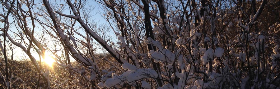
So, I finally get all organized, shoes and spikes on, just as it’s barely starting to get light out when I start up the trail–I’m leaving fresh prints, but that’s to be expected. All is fine and dandy, though as I ascend closer to the ridge (which runs on a north-south axis) I can hear the wind, which I think has actually started up because the sun has risen (energy input into the system). Reaching the junction on the ridge proves me right: yep, wind. No problem, winter, right? It would seem as if the drifts of the other day were a simple appetizer, just a smidgeon of the main course to come…
My main source of surprise comes from the fact that HL/JB-017 Unjangsan is a fairly popular mountain, receiving busloads (really!) of hikers coming to make the loop (which doesn’t get closed off during fire season these days) that culminates between Dongbong (Samjangbong), Unjangdae and Seobong (Chilseongdae). However, the trail did not seem very broken in, at all. Even to the point where I had to break trail in parallel, off to the side of the main path, because of the drifts. The drifts are in the areas sheltered by the wind (hence the snow gets deposited there) and was shallow, guess where? On the windy upslopes a few meters west of the ridge’s crest! We’s gots cold and numbness here in the ROK, but I haven’t thought of frostbite in years, possibly decades. In order to facilitate the ascent, I had to remain exposed to the wind–not fun. Then there are those stretches where you don’t really have the choice but to stay atop the ridge (nice drops on both sides) and face the drifts. Ah, the drifts. Did I mention there were snow drifts? There’s a first time for everything and this is the first time I’ve wished I had snowshoes in Korea: trying to advance, uphill, and breaking through chest-high banks of powder. Seriously? I don’t think there had been more than 15cm of actual snow that landed on the ground, but now it was all right here.

Irgendwie, finally arriving at the summit just a bit after nine, I didn’t wish to fool around and lose the heat I had been generating plowing up the hill (for what seemed ages, but around two hours for the ascent isn’t /that/ bad…it’s quoted at an hour for that trail, can take one and a half loaded down with gear, so I’ll take that given the conditions), so I quickly set up the antenna (5s collinear, as per our “nail-it theme” this month) and set up shack sweet shack in the bothy bag. The actual activation itself wasn’t very punishable, having been completed within a half an hour–quite smooth for a weekday morning.

Despite stunning views in all directions, today would not be a day to dilly-dally up in the activation zone, especially were I to stick to my original plan of activating two summits. I have to say that during the activation, my mind was leaning more and more towards not doing JB-020, but was open to checking it out as far as descending via Kalk Pass–however some of my antenna segments had gotten stuck in the tree while dismantling and sortof cemented the thought that a second activation would not be possible today. That, however, did not stop me from still taking that route (breaking trail should be easier going downhill, no?) plus it should be a bit more out of the wind…

바보…I should know better, as it isn’t all descent, but those places it wasn’t that bad, just a newly developed hole in the side of my shoes was beginning to make itself apparent breaking the banks. Then some uphill through the snow, then down again, until the pass…eh…Gomjigi? Nope, this bear was not going to be crossing that mountain today–I came down a better trail, I’m not going up that path. Down the access road it is!
Five minutes later I am thawed out enough that the thought crosses my mind “maybe I can do it today.” That’s a 400 meter elevation difference talking there–the weather hasn’t changed up there. Besides, my shoes were sloshing around, now that everything had melted. That wouldn’t be a good idea. Moving along, people. Going down this road with its many switchbacks is actually longer, but more comfortable. At one of the curves, I had the impulse to look up–what did I see? The very same ribbon I strung up three years ago marking the end of the shortcut between Naecheo Village and this road (because to follow this road all the way to the bottom, a bit to the east and then back up again to the main trail head and parking lot would add an additional 1.5 km or so). No joke!
Twenty minutes later and I was back down at the parking lot, still the only car there, so I assume the only client of the day for Unjangsan. Not before rustling up a doe just above the farms…

On top of Jeonnam!

Every direction you turn these days, there’s a wedding…’tis the season! Gotta get’em all done before next [lunar] month–or else…
요즘 어디든지보면 결혼식이 있다…윤달전 빨리 빨리 해야지!
Yesterday, Se-heui tied the knot, so Saturday was out of the picture, thus Sunday really had to count. Problem these days is that it’s technically still fire season, and so many of the possible “double activations” have one of the two summits cordonned off. Luckily enough, down south, just to the east of Suncheon, a nice trio of summits was 100% open: HL/JN–005 Dosolbong, HL/JN-004 Ddalibong and HL/JN-002 Baekunsan. I’ve been to this Baekunsan before, back in December of 2011 with DS4GKA (based in Yeosu), but only that one summit, not visiting/activating the other two.
어제 세희는 결혼 해서 토요일오후동안 거기서 있어 산으로 못 가서 일요일에 가면 진짜 잘 해야 됐어요! 산불기간 아직 못지내서 너무 많은 “더블 운용” 산에 두개중에 하나는 통제이다. 그렇지만 남쪽에, 순천보다 동쪽에 3까지 같이 산 다 진입가능 해요: HL/JN-005 도솔봉, HL/JN-004 따리봉과 HL/JN-002 백운산. 예전에 2011년 12월에 그 백운산에 여수의 DS4GKA같이랑 갔은데 그때에 나머진 따리봉과 도솔봉으로 방문 할 수 없었어요.

To make it all work, I left Iksan at 4AM and 6K5ZLH left Daegu even earlier, to converge at the trail head just before dawn. We made sure to travel extremely light, since we’d have to be climbing into three different activation zones today (minimum 150m x 3, but actually more!), starting towards the west to knock off the shorter summits, first, then descend down one of the eastern valleys after Baekunsan.
어떻게 했나? 먼저 새벽 4시에 익산에서 출발 하고 (ZLH OM은 대구에서 더 일찍 출발 했음!) 산입구에서 (어떤 송어회집앞) 일출저네 만났어요. 오늘은 운용지역 3까지 (150미터이상 오라가기 3번) 예정 있었으니까 침을 가볍게 준비 해야됐어요. 먼저 서쪽으로 올라 가고 제일 작은산 맞이고 계속 동쪽으로 이동하고 마지막백운산의 운용을 완료하고 거기서 계곡으로 하산 함.

Having started just as the sun was rising the going was easy, along a gently sloping forest road before that ended and turned into a real trail, zig-zagging through the creek bed. Reaching the ridge line between Ddalibong and Dosolbong then continuing up to Dosolbong we summitted just before nine o’clock, quickly set up and proceeded to activate in good time, despite the earliness (for 2m, it was early, anyway). Seeing as we still had two more mountains to activate, we couldn’t stick around calling CQ all day, so having completed the bare essentials, quickly packed up and moved along.
일출 뽀면서 우린 편안한 임도로 시작 했지만 도로 끝나서 진짜 산길 달랐어요. 능선까지 계곡으로 (개단도 추가있음) 올라 가서 도솔봉정산에 9시전 이쁜 햇볕 만진 남해 보고 있었다. 장비 빠르게 설치하고 운용을 바로 시작 했음–2미터에게 시가이 좀 일찍인데 운용 문제없이 편리하게 끝났어요. 산 2개 남아서 여기서 하루종일 놀 수없어서 교신 많이 못 했어요.

The timely descent from Dosolbong and picturesque ascent to Ddalibong found us at our next goal around 11. I say the ridge walk on the way over was picturesque because along the way we could catch regular glimpses of HL/JN-/JB-/GN-001 and JB-003 as well as a precariously positioned tree, growing atop a cubically shaped boulder and jutting out horizontally into space (the tree, that is). I had to stop and take it in from all angles.
따리봉해로 도솔봉에서 하산 빨리 했고 능선따라가면서 양쪽으로 보면 완전 멋있는 배경들 볼수있었어요…북쪽을 보면서 지리산 종주를 전제 있었다: 노고단에서 반야봉과 토끼봉 쭈~욱 천왕봉까지 깨끗하게 새로운눈에서 나왔어요! 그리고 중길에서 큰 사각형바위에서 가로의 나무가 기울고 있었어요! 정말 난 모든 방향에서 확인 해야댔어요! 암튼–따리봉에 11시정도에 도착했어요.

Whereas Dosolbong we had all to ourselves, Ddalibong was definitely bustling–especially since lunchtime was approaching, the smell of ramen was in the air! Potentially sacrificing our signal just a wee bit (that portion which would be projected north, that is) we decided to set up on the wooden porch for the convenience of the level/vertical posts with which to use to set up the antenna. Just to the north of this porch and the summit marker was some earth/rock rising up about 3m…thought it wouldn’t matter much, but it did make a difference in the end, as was evidenced in signal reports from Jeonbuk.

우리는 도솔봉 스슬로 지낼수 있었는데 따리봉에서 인간수 더 많아서 점심시간되니까 라면향이 났어요. 정상에서 남쪽방향에서 나무로만든 베란다가 있었어서 저기서 안테나 편리하게 설치 할수 있어서 운용위치 선택했음…그렇지만 바로북쪽에 (마커표나서 땅 아마 3미터 오라왔어 우리 전북 신호가 좀 먹었어요.
Taking into account, reduced signal (just a little), lunchtime lull as well as some snacking of our own (when will I learn not to bring my own food up mountains??? We got all kinds of stuff: more tangerines (I already brought a dozen with me), a huge sweet potato (why not?), etc. Really–the day I plan a through-hike of the country, if I play my cards right, I could really travel light!) this activation took a bit longer to complete. Though, it did work. Then down again, onwards then upwards to the third and final summit, Baekunsan.
모든것을 개산하면: 줄림 신호를 (조금만), 점심시간 주파수의 진정을 그리고 자기간식하기를 (정말–난 생각 잘 하면 밥없음 백두대간 전체 가능해요…오늘은 뭐…감귤 (더!), 왕고구마, 초코, 등) 때문에 이 2번째 운용은 더 오래 걸였는데 합격 됐어요! 그다음: 하산하고 또는 오늘의 3번째와 마지막의 꼭대기 백운산 오라갑니다!

At the bottom of the dip in this last section of ridge lies another forest road, the same which I ascended with DS4GKA back in 2011, and I had half the mind to descend via this route, especially if it were snowy (which it was) having brought a sled to allow the going to go a bit faster…however with our route choices this time around, it was not to be. Either way, it proved an opportune time to crack open and share a nice dark Czech doppelbock that ZLH had lugged up and down the first two summits~!
아래쪽에 있는 고개에서 임도가 하나도 있어요: 2011년에 DS4GKA OM님이랑 오랐어요…이번에 설매를 거의 가지고 왔어요–그대로 하산 정말 빨리 할수 있는생각 했지만 이번엔 산길선택 떼문에 못 했어요. 아무튼 거기서 ZLH의 배낭에 나온 체코 또펠보크 흙맥주를 나누서 조금동안 쉬었어요!

The final ascent on up to Baekunsan was definitely the longest, which is why we saved it for last, to not burn out before hitting the other two peaks! With plenty of chances to take a rest, the view back to today’s previous peaks was quite nice!
우리의 마지막 등반 확실히 오늘의 제일 길은 것, 그래서 마지막으로 예정했어요. 휴개위치들이 많아서 우리 벌써 지난꼭대기의 배경을 자주 볼 수 있었어요!

Baekunsan consistently gives good views of Jirisan, probably since it’s to the south thus the lighting is better…always from other summits such as Deogyusan, etc to the north, most of the time all we get is a silhouette in the distance.
백운산에서 지리산의 보기를 항상 잘 나와요…아마 이 방향에서 빛은 항상 더 좋으니까요. 다른 북쪽있는산에서 (덕유산처럼) 지라산에 보면 그림자 그림만 나와요.

Endlich! Finally arriving at Baekunsan’s summit, snap off a couple photos then set up….only finding a good supporting signpost where I activated in 2011, we weren’t quite satisfied with the signals (or lack of people responding leading to perceived bad sigs), so moved up from the south face up to the crest of the summit, taking turns to hold up the antenna while the other was activating, all to ensure transmission of the best signal possible.

마침내 백운산정상에서 도착하고 사진 몇장을 찍! 찍! 찍고 설치 하고…아이…저번 2011년에 사용한 마커표나무대밖에 좋은때 못찾았지만 (거기서 신호가 그렇게 좋지않았음) 꼭대기바위바로옆으로 이동했고 한명은 교신하면서 다른사람은 폴대를 잡고 제일 좋은 신호 송신 했어요.
However, still it seemed to be difficult, to the point which I was fishing for contacts on the local Echolink node (not successful, but an OM in Pohang was eager to chat) as well as 6K5CSL over in Sacheon (by Jinju) was also trying to rile up chasers for us!
아직도 4국까지 힘들어서 에코링크에서 낚시를 해보고 사천엔 6K5CSL은 우리위에 씨큐 불고 있었어요!
In the end, we did manage to squeak by, wrapping up the whole affair by 16:30, not without observing a helicopter rescue just to the east of where we were. Always some excitement on top of the world!
마지막으로 운용 되였어요–16시반까지 완료, 바로 동쪽엔 헬기구조도 봤어요! 세상위에 우린 심심하지 않아요!

First 6k0fm activation–비슬산 조화봉

It was definitely a touristy weekend–hitting the must sees, picking up a rental car (SM5), watching “check transmission” messages flash across the dash an hour outside of town, running around to different garages, photo ops in front of this pagoda and on that bridge, rain showers, road construction, LDW, opened up restos and motels with A/C.

First stop was actually at Haeinsa Temple, on the southern slope of HL/GB-001 Gayasan, but with no ascent. Simply wandering around the grounds, investigating what we could of the Tripitaka Koreana through the wooden slats, and cold drinks. (Thanks, Zoom! You’re a good friend!)
We then completed the last leg to Daegu, found lodging, then 고기. Meat with the windows open–don’t we like that? The Koreans don’t take it out to the sidewalks like the Chinese do, but it’s better than completely inside.

The next morning, an early start for Sunday! ZLH came on by to pick me up on his way out of town, heading south into Dalseong County. We were originally aiming for a trailhead at 유가사 temple, but took a wrong turn at 중뫼 and ended up taking the ascent from the Recreational Forest entrance, thus instead of actually heading up to the main peak, we went up to Johwa Peak, which happens to be the secondary AZ just at 25m below the main peak.

Honestly it’s just as well, since the whole time we were engulfed in fog, we were lucky we could get a shot of the national weather administration’s radar tower (see left) visibility was so low. Before activating, we took a gander inside the tower, it’s open for visitors, and I’m sure commands a great view on clear days. Today we didn’t run into 6K5ZPC, who actually works here and has a station set up!
Additionally, the road which leads up to the radar tower (not everyone walks up!) terminates with the highest bridge in Korea! It’s not a mini bridge, either!
Once we set up, it started to rain again, lightly, but not so hard that we rushed through the activation. We had fun making a few domestic S2S contacts as well as giving a CQ Japan call out–with much success! All that on 2m with only an HT connected to the 5s GP!

Well, remembering that others were waiting at the bottom of the hill in town we couldn’t lollygag all day up there, so we went back down the same trail we came up, seeing many more hikers than during our ascent. On the road back into town we stopped to have some cow elbow soup….the cartilage is good for your skin, eh.
Arriving back in town and regrouping, we headed back to Iksan, to return the car and upgrade for a Grandeur. Filling the tank on that thing before was very painful (compared to the Pride), let me tell you!
Synchronized SOTA 20110205

The stars aligned on Saturday, or, well, at least the Yagi elements did! There were three SOTA activations going on right around noon time today in HL land–6K5ZLH Wan-seok on HL/GB-001 가야산, HL4GKR Gi-bong on HL/JB-139 오봉산 and I on HL/JB-017 운장산.
Initially, ZLH’s activation was to be solo, and I was organizing our ascent to the summit to coincide with his to get some S2S action (Ji-hun came to tag-along today). Then his schedule moved later, then even later yet when his hiking partner decided to join him. In the end, we were shooting to be on top between 1 & 2 in the afternoon. This worked out nicely, with great weather the whole duration of the hike–sunshine, out of the fog, very light breeze…I only needed a sweater on the summit, and I got my first sunburn of the year. Bravo.


As mentioned before, we were out of the fog, which had been pretty thick both Friday and today in the morning. However, as soon as we reached the top of Pi-am Pass (where the parking lot & trail head are) we were out of the clouds and into the sunshine.
Above we have a view to the westerly mountains poking up and below the view to the north, both panoramas taken on the way up at approximately 800 m asl.
Alas, GKR reached his summit about ten minutes before we did and we had a short chat, then first thing upon reaching the summit I called over to him (he was only 35 km away with an HT) to have my first official QSO of the day. Afterwards, some burritos I brought up were warmed with a leftover MRE warm-up kit, and the yagi set up in the meantime.

With the exception of YOP on his bus running mobile who I have a tendency to lose going through tunnels, all QSOs were at five watts. Signal reports were pretty good as well as the distances, however a nice S2S to HL/GW-001 Seoraksan took the cake for the day with a distance of 260 km, and both of us at 5W! All in all, a much more pleasant activation than the last one in July, in the middle of a cold, windy cloud getting soaked!
6K5ZLH activated his summit and left rather quickly as it was chilly where he was, plus the ascent was four hours and much the same again for the descent. HL4GKR unfortunately didn’t activate, having only the single QSO with me logged, I guess he didn’t get any answers to his CQing on HT–better luck next time…

Songnisan CB-014 on 20100822

Left Iksan at 3am to meet Taek (who we met on the boat coming back from Dandong, China, at the beginning of the month) and climb Songnisan. 1058m. 8 points. An HT. An antenna I can’t use. A hat forgotten in the car. Likewise an antenna mast left in the back seat, too. A full LiPO battery. No camera battery. One low cell phone battery. One presumably full cell phone battery (actually 100% dead). One person of the three in the party who split off and took the wrong trail. 2L of Pocari Sweat. The smell of stale Makeoli wafting off the rocks. I think you get the idea…
The interesting aspect of this activation was the two activation zones (4km apart from each other) as well as the (to be verified) impressive distances made via a simple HT running at 5W with no special antennas (apart from the non-stock Diamond-6dB-better-than-a-duckie). I made a few (4!) S2S with GW-004 (x2), GW-206 and GG-015. Now, none of these people were operating “SOTA” so I’m not sure of their access or precise locations on the summits (in the AZ, etc) but from taking a quick look at some of their web pages, these might be legit activations. We’ll see….(if so, that’ll make 22 chaser points for just one day!)


more images to come! no movie, though (no battery, eh!)

***EDIT***Verified some of those S2S potentials, SHC is in, GRP/GFM unfortunately not. While they were operating portable using a 50W mobile rig that they dragged up top, they were on the helipad of Hambaeksan which is at ~1530m, out of the AZ by about 20m (they were trying to get out of the way of the big antenna signals on the very top…) Next time!
20100723–JB-017 Unjangsan


I managed to pull off an early morning 8 pointer activation this morning before class on Unjangdae (1126m, within the AZ of Dongbong which has 1133m) just barely squeaking by with 5 QSOs (it was a weekday morning, after all).

I did manage to shoot a lot of better footage this time, so there will be a decent video out later…

Gotta get that antenna up there somehow!


This mountain also has no access during the spring and fall fire seasons (February 15 to May 15, October 20-December 20). If you do indeed go, you risk a $100 fine….


