Aftermarket Ansan Activation
The second Sunday of the month is always a special one. Well, by the reasoning I’m about to present, technically every Sunday of the month is always a special one. It’s hamfest day! The second Sunday of the month just happens to usually be just a tad bit bigger and more bustling than the others, since it’s the hamfest (termed junk 정크 in proper Konglish) in Seoul, in the baseball field at Yonsei University. I like to go when I can, to pander the program and get people interested in SOTA.
Additionally, after this month’s market (July 10, 2011) was a SOTA presentation at the university, which HL1FB so graciously helped to get a room with projector for hosting the event and showing a power point presentation about the program.
Not only was that going on, but also since the main audience was the 6K0FA 청룡 Scout Troop, we planned a hands-on activity with HL1WOU (and DS2NED to help out) to make portable slim-jim antennas with the students for the 2-meter band which they could take home and use on their own hikes when operating portable.
After the antenna activity was complete, the scouts had another engagement to move on to, so I decided to head up the hill behind the University, HL/SL-008 Ansan, for a quick activation before what looked to be rain later in the evening.
It’s a nice short hill, one of the lower summits in the Seoul area, in what amounts to a city park for many who live on its peripheries. I went via one of the back access roads of the university to later descend on the opposite side by the metro station.
When I got up to the top, with a large stone tower and a few people hanging out, I thought it better not to set up the good antenna with all the dark clouds about, so I HT‘ed it so I could get out quickly when it did start.
Even more fun is that 6K2HVZ contact I had–was actually one of the scouts that had been in the group this afternoon!
Good thing I didn’t set up everything, as when I was finishing up my fourth contact, the umbrella came out! Eh, activation complete–hopefully next time it’ll be nicer out for longer. Back to the bus station it was, get a ticket and some goat cheese. Don’t see much goat cheese down in Jeolla, but we do see some goats sometimes….
Seoul On The Air 20110702

(DS1GKD, HL1KFB, N5ATY, HL4ZFA, DS1RDJ, DS1DAT / HL1KKC, HL1IWZ, HL1IYQ, HL2OLP, HL1WOU, F4AAR)
(See 6k0fm.net for the bilingual wrap up of the event, click here)
Big weekend! Thanks to a spark from HL2OLP about a month back regarding an immediate goal of his to activate all 11 summits in the Seoul Metropolitan area (fairly reasonable), especially since after a year of SOTA in Korea they all haven’t been activated yet (one would think that region would be the first to be “ticked off the list” for most given the local demographic.
Me thought to myself that along the same lines why wouldn’t it be possible to stick an activator on each of those eleven summits for an afternoon and make some QRM? Well, the idea took off, and while we didn’t fill up the region 100% we did create quite a racket!

We lost a couple of activators at the very last minute due to a quick date change (rain was scheduled for Sunday the 3rd, so we moved back one day to beat it), but there were also a few random appearances on the hills (not necessarily all in Seoul) but welcome none the less.
Another fun facet of such an event is the points potential, for everybody, not only a wide selection of activators to work from home for the chasers but S2S galore–it was basically a big party on the air–hell, even the cops came! DS1DAT was asked to leave the premises by the military police on HL/SL-004 Inwangsan (military area, open to the public six days a week). That’s pretty much a crap-shoot–nobody bothered me last year when I set up a big honkin’ Yagi up there in the evening (delivered that very same afternoon by DAT himself!).
I chose from the leftovers HL/SL-003 용마산 to activate with F4AAR Laurent–a hill which I had had yet to visit, not terribly low (though low enough to bring full QRO gear). F4AAR brought his newly acquired toy, an SDR radio (a Flex 1500) to do some testing in a hopefully less noisy environment than his flat.
We did have a decent party going on up there, a bunch QSOs in three languages, loads of S2S action, a bottle of red, a freshly made liver mousse as well as some garlic flavored frischkaese. Even though the kit was QRO, the majority of contacts were QRP, thanks to the 5 segment colinnear, we were reaching over into Gangwon-do and down into Chungcheonnam-do.

2차 was happening downtown at a nice charcoal grilled 닭갈비 place (friend’s resto) where propoganda and awards were given out to the top contact makers who showed up–a special edition SOTA hanji pencil cup designed and executed by N5ATY. DS1RDJ took the cake for the top activator (some might imply she has an unfair advantage, all the guys wanting to get a QSO with her….;) with HL1KFB coming in second of those at the restaurant.
After filling up there, we headed through a park and over to a beer joint for 3차, where the imbibing continued on well on after we had to go to catch our (almost last) bus back down to Iksan.
The consensus is that the event was a success, with a lot of people having a lot of fun, likewise with the meet-up afterwards to see all the various activators’ faces in person in one place. It’s safe to say that this will become an annual tradition every year in July for the HL SOTA Association’s birthday! See you next year on the air in Seoul! (Actually, probably much sooner than that…!)
Korea QRP Club outing

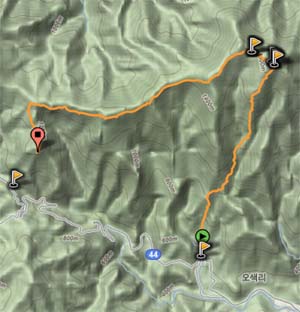
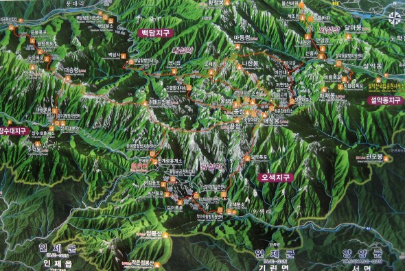
Activating HL/GW-001 설악산 on June 5, 2011 was an endeavor that took about 25 hours. HL1KKC and his Korea QRP club arranged this trip, last time having done it in 2007. After having trucked up to Seoul and meeting 6K5ZLH (who also had to find his way up to the Special City), grilling and eating some porcine flesh on the sidewalk with N5ATY, we took the subway to the other end of Seoul to meet the others at 11 PM and hop on their bus that they had out for the excursion. It was well arranged, we arrived and literally thirty seconds later it was like “here’s your beer, the meat’s on the bus, hop on and grab a seat.”
You’ll note that the departure time was quite late–that being because our hike started quite early: 3 AM. We arrived at the Hangyeryeong Rest Area sometime around 2 o’clock to eat and get ready (this wasn’t our point of departure, rather our final arrival point later on that day). The place was crawling. No place to park, the food stands open and running, the bathrooms steaming, traffic not flowing, really. It was hopping more than those huge pullovers next to eight lanes of traffic at the same time!
We got back into the bus and started on our descent to O-saek Yaksu (it is lower) twisting and curving along the road until hitting this other “rest area” though not the area proper. There was a good quantity of people milling about, and even though it wasn’t quite three o’clock yet, the trail was open and one could just barely see the lights bobbing up the hill in the trees.
The way up was actually quite normal, just a bit longer (it is a trot up to the top, there!), we took a couple of short breaks on the way up, and upon arriving just below the summit at maybe a quarter to seven, out of the wind and waiting for the rest of the group, HL1WOU already already had a slim jim thrown up into a tree and was making 59 QSOs to Seoul, 140km away with his HT. We had to wait out of the wind, because although we may had been hot at the bottom it was actually quite chilly (very chilly?) up on top!
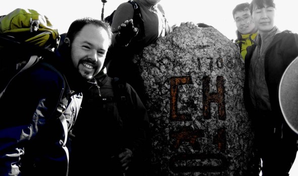
At about ten after seven, we had everybody amassed together again, and set out to brave the crowd on the summit. This is seven AM, not New Year’s morning, and there’s a crowd. On top of Seoraksan, Daecheongbong, there are actually two markers. For each marker there are two lines: one for the photographers, one for the photographees, naturally the two lines advance at the same rate as you have things pre-arranged with your group. Hence the two summit shots above, and not necessarily with everybody coordinated together!
I chose “the sunny side” of the summit to set up initially, it was in fact sunnier, and a bit less breezy. I actually activated from that position, making my first four contacts of the day, including with Mr. SHC who was starting out on his way to that very same summit from a different point down below!
After these first QSOs, we decided to move more over to the westerly side of the summit, finding a rock from which to operate behind, out of the wind, a decent location for the antenna, also.
Much of activation was conducted using five watts, CQing at higher levels to break through people’s squelch at home–however, for those closer contacts that were more tucked into the hills the going was tough even at fifty watts (though almost 300km away to Iksan on five watts brought me a 55 report–that’s with no GP, no Yagi, just a two segment mobile whip!)…
6K5ZLH and I operated on and off until about half past eleven local time to both activate. We were graced by some visits, first DS1RZP, then DS2SHC. We then packed up and headed down to the shelter where HL1KKC and his crew were operating, getting lunch ready, eating or napping in the sun. While down there and catching up on the news, we found out that evidently a hiker who also took to the trail that morning didn’t make it up, having a heart attack on the trail (there are some warning signs at the more popular high peaks outlining the dangers, which are more present at the “must see” destinations that see a much broad range of skill sets attempting the trail). Actually, later on in the afternoon during the descent we saw another rescue helicopter out looking for somebody–not sure it’s increased risk or simply an increased quantity that shows the normal risks that exist at any time.
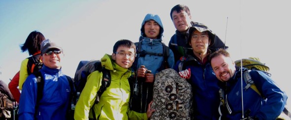
At one o’clock, after having taken the group shot below, we started our descent, rather, what I thought was to be our descent. Hangyeryeong is a few hundred meters higher up than Osaekyaksu, but the path there is still a good distance. There were a few times when we passed markers indicating our elevation was “currently” 1300 meters–wait, we’re supposed to be coming down from 1700 to 800, when’s it gonna happen? We had quite a few re-ascents right up until the end (I can’t say it wasn’t an interesting trail…some of the views were quite spectacular), then four hundred meters of drop all in the last (less than) two kilometers!
Though ZLH had so graciously offered to truck the 12AH SLAB both up and down, with the 857 and other equipment I was still eager to lose that heavy load, hence my lack of excitement when the reality of the “downhill” came about 😉
At the bottom after a nice cool head rinse, tea and re-hydration spirits were much higher again.
Eventually, everyone made it down (gravity happens) and the fully loaded bus started moving west, only to pause a while later once we got out of the mountains for the obligatory 닭갈비.
As for the rest of the trip, I don’t think much was remembered by anyone, as everybody was sleeping until we got to Seoul, dropped off by Seoul Station at half past midnight…such a late arrival wouldn’t even be enough to stop me from even a mini-activation the next day…
Sur le BS–pour 200 points!

For my first ever activation in Busan, and final activation for the long weekend, I chose to pick my fight with 금정산 HL/BS-001, the highest summit in the Busan metropolitan area. Activating this summit, Godangbong, pushed me over the 200-point mark–and it’s surprising how much more quickly that second batch of one hundred points seemed to pass by than the first one (though the time frame is roughly the same)!
고당봉 is located at the northern end of Geumjeong fortress, and I chose to access it via Beomeosa temple, first taxiing it up to the temple then catching the path there for the remaining 3 or so kilometers to the top, passing through the north gate, aptly named 北門. Skipping the bottom leg of the trail was partly because of time constraints as well as to not use all my energy before the next day’s (Sunday) ARDF event also being held at the fortress. I now know that this was a good move since down below it was much hotter, even as far up as the temple, but once I was about 200m higher than the temple the temperature was much more tolerable and fresher.
For the walk itself, I wasn’t sure what to expect, as the particular reviewer who had covered this part of the “Busan experience” in the Lonely Planet Korea took, let’s say, a negative stance, basically dissing anything and everything about the mountain and surrounding fortress. While from my only previous experience of Busan I can’t say I gave the best evaluation of the city either, however when wandering around this area (for two days, at that! Including the ARDF on Sunday) I have to say that I liked the fortress, and found the facilities to be perfectly adequate. I was duly impressed by the city’s efforts at renovation, plus the “solar trail markers,” but I’m still trying to figure out why, exactly, they were solar (I wasn’t around late enough to see if they lit up or anything)… Maybe the person was expecting a cable car to the top, a kiddie train, and a changing of the guards enactment to videotape with a shaky hand never to watch again as grading criteria.
This was planned to be a VHF-only outing for a couple of reasons, one with the intention of a S2S contact with DS2NED on HL/CN-004 O-seosan, and also to make some local contacts in the area. Additionally, since it was a Saturday afternoon, chances were good that somebody else out and about on a mountain somewhere would have an HT turned on.

Upon arrival at the peak and photo shoot I set up the 2 segment mobile whip I was to use and set about scanning the dial, firstly looking for DS2NED. While scanning the lower segment of the 2m band (in SSB) I came across a signal, which was actually HL5BSS having a QSO in AM with someone else who I couldn’t hear–I tried to make contact but wasn’t too successful. Though that was an interesting experience. Moving back up again in FM, I came across NED‘s voice, and sure enough it was him, coming in 58 from the top of Oseosan. I got in line and had a quick contact with him before he took a break to have a bite to eat, said he could pick me up at about 57 over there. Not too bad, as it’s almost opposite ends of the country!
Over the next couple of hours I had a steady stream of contacts all around, west to Gimhae and Changwon, north over Ulsan and Gyeongju all the way up to Pohang and towards Daegu, not to mention down town with a bunch of locals. I also had some QSO’s with a bunch of OPs who I’d see on Sunday at the ARDF race, including a few who were out setting up the course around the fortress for the event in advance. I would’ve kept going but was already late for the planned dinner arrangements so had to cut things off at 6 o’clock (and the battery wasn’t near dead yet!) and head down the hill back into town…

Upon approach to the north gate in scaffolding, it was plain to see people were hard at work here. There was a caterpillar moving rocks up and down the wall to the east of the gate. On the other side (the inside) was the indication (on the right) indicating the phases of renovation that the fortress is undergoing (will undergo) until 2026 (that’s a ways away!). There was also a stone shop where they were cutting and chipping new stones for the fortress walls. It seemed as if they were using a rock saw for the basic shapes then chipping them down to size in addition to giving the blocks a more rustico appearance.
While at this workshop I got to see the “forest fire horse,” a man (ranger?) riding the trails on the horse sporting a “산불조심” emblazoned banner over its mane.

Taken from another sign whose image I couldn’t get to come out in the photo:
Its tip composed of a huge granite mass, this peak of Godang-bong was named after Gomo, a goddess of heaven, who according to a legend based on Taoism, came down here to become the goddess of the mountain (there is still a praying place called Gomodang near the very top). This is the highest of about ten peaks on Mt. Geumjeong with a huge dragonhead-shaped stone called Yongduam at its breast part and a shallow well called Godangsaem at its southern waist part. At its eastern waist part lies a spring called Geumsaem or Geumjeong [金井] (which literally means ‘a golden spring’). A legend says that a golden fish came down from the world of Brahma [梵天:Beomcheon] in a five-colored cloud and lived in the ‘golden spring.’ The names of the mountain (Geumjeonsan) and the temple (Beomeosa) originated from this legend.

경기-015 북한산–the Everland of mountains
Arriving at Bukhansan Fortress for the last 50 meters of ascent, I seriously felt like I was waiting in line for a ride at Everland–a long line of people snaking up (and down) the summit, inching along at intervals, to push past the protest monument at the summit and shoot a summit photo…yes, up to that point there had been many people on the trail, or rather, expressway, leading up the mountain. Just at the trail entrance where we entered, we let a group of 81 pass before weaseling out the geocache located there and signing the log.
Even though I brought the Yagi, I quickly discovered there wasn’t much real estate on the summit to put it together, so this was an HT only activation. It was my first activation using the newly acquired VX-6R, but man, that thing gets hot quickly! I had taken out the battery and was using the LiPO externally to power it, but it was still hot to handle, subsequently causing me to lose the PTT mid-transmission sometimes…had I been using a better antenna, I could’ve lowered the power (in my tests with the lower power settings, the signal reports were not good).
I managed to have a double eyeball at the summit itself, as is evidenced above, with DS2SHC (with whom I’ve made a S2S before, from Songnisan) and HL1IWZ. SHC happened to be at the bottom of the mountain and responded to one of my CQ calls, informing me he’d be up top within the hour. Additionally, I had two S2S contacts (both to GG-044!) with HL1KFB and DS1RRG.


