First 6k0fm activation–비슬산 조화봉
It was definitely a touristy weekend–hitting the must sees, picking up a rental car (SM5), watching “check transmission” messages flash across the dash an hour outside of town, running around to different garages, photo ops in front of this pagoda and on that bridge, rain showers, road construction, LDW, opened up restos and motels with A/C.
First stop was actually at Haeinsa Temple, on the southern slope of HL/GB-001 Gayasan, but with no ascent. Simply wandering around the grounds, investigating what we could of the Tripitaka Koreana through the wooden slats, and cold drinks. (Thanks, Zoom! You’re a good friend!)
We then completed the last leg to Daegu, found lodging, then 고기. Meat with the windows open–don’t we like that? The Koreans don’t take it out to the sidewalks like the Chinese do, but it’s better than completely inside.
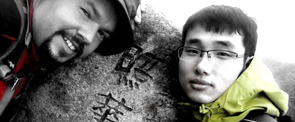
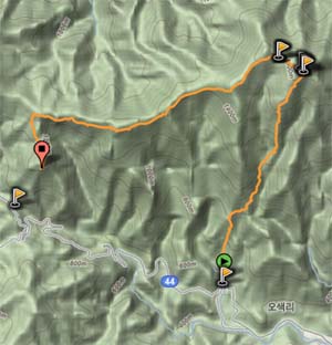
The next morning, an early start for Sunday! ZLH came on by to pick me up on his way out of town, heading south into Dalseong County. We were originally aiming for a trailhead at 유가사 temple, but took a wrong turn at 중뫼 and ended up taking the ascent from the Recreational Forest entrance, thus instead of actually heading up to the main peak, we went up to Johwa Peak, which happens to be the secondary AZ just at 25m below the main peak.
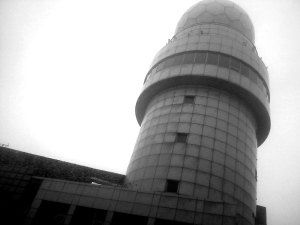
Honestly it’s just as well, since the whole time we were engulfed in fog, we were lucky we could get a shot of the national weather administration’s radar tower (see left) visibility was so low. Before activating, we took a gander inside the tower, it’s open for visitors, and I’m sure commands a great view on clear days. Today we didn’t run into 6K5ZPC, who actually works here and has a station set up!
Additionally, the road which leads up to the radar tower (not everyone walks up!) terminates with the highest bridge in Korea! It’s not a mini bridge, either!
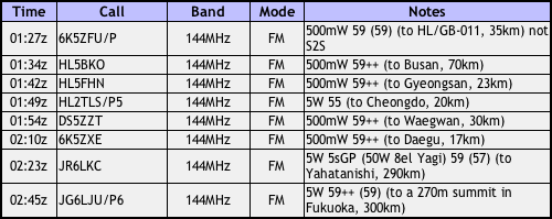
Once we set up, it started to rain again, lightly, but not so hard that we rushed through the activation. We had fun making a few domestic S2S contacts as well as giving a CQ Japan call out–with much success! All that on 2m with only an HT connected to the 5s GP!
Well, remembering that others were waiting at the bottom of the hill in town we couldn’t lollygag all day up there, so we went back down the same trail we came up, seeing many more hikers than during our ascent. On the road back into town we stopped to have some cow elbow soup….the cartilage is good for your skin, eh.
Arriving back in town and regrouping, we headed back to Iksan, to return the car and upgrade for a Grandeur. Filling the tank on that thing before was very painful (compared to the Pride), let me tell you!
Korea QRP Club outing
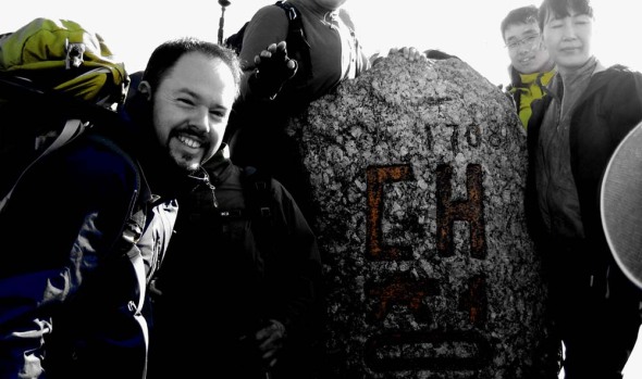
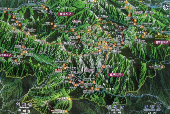
Activating HL/GW-001 설악산 on June 5, 2011 was an endeavor that took about 25 hours. HL1KKC and his Korea QRP club arranged this trip, last time having done it in 2007. After having trucked up to Seoul and meeting 6K5ZLH (who also had to find his way up to the Special City), grilling and eating some porcine flesh on the sidewalk with N5ATY, we took the subway to the other end of Seoul to meet the others at 11 PM and hop on their bus that they had out for the excursion. It was well arranged, we arrived and literally thirty seconds later it was like “here’s your beer, the meat’s on the bus, hop on and grab a seat.”
You’ll note that the departure time was quite late–that being because our hike started quite early: 3 AM. We arrived at the Hangyeryeong Rest Area sometime around 2 o’clock to eat and get ready (this wasn’t our point of departure, rather our final arrival point later on that day). The place was crawling. No place to park, the food stands open and running, the bathrooms steaming, traffic not flowing, really. It was hopping more than those huge pullovers next to eight lanes of traffic at the same time!
We got back into the bus and started on our descent to O-saek Yaksu (it is lower) twisting and curving along the road until hitting this other “rest area” though not the area proper. There was a good quantity of people milling about, and even though it wasn’t quite three o’clock yet, the trail was open and one could just barely see the lights bobbing up the hill in the trees.
The way up was actually quite normal, just a bit longer (it is a trot up to the top, there!), we took a couple of short breaks on the way up, and upon arriving just below the summit at maybe a quarter to seven, out of the wind and waiting for the rest of the group, HL1WOU already already had a slim jim thrown up into a tree and was making 59 QSOs to Seoul, 140km away with his HT. We had to wait out of the wind, because although we may had been hot at the bottom it was actually quite chilly (very chilly?) up on top!
At about ten after seven, we had everybody amassed together again, and set out to brave the crowd on the summit. This is seven AM, not New Year’s morning, and there’s a crowd. On top of Seoraksan, Daecheongbong, there are actually two markers. For each marker there are two lines: one for the photographers, one for the photographees, naturally the two lines advance at the same rate as you have things pre-arranged with your group. Hence the two summit shots above, and not necessarily with everybody coordinated together!
I chose “the sunny side” of the summit to set up initially, it was in fact sunnier, and a bit less breezy. I actually activated from that position, making my first four contacts of the day, including with Mr. SHC who was starting out on his way to that very same summit from a different point down below!
After these first QSOs, we decided to move more over to the westerly side of the summit, finding a rock from which to operate behind, out of the wind, a decent location for the antenna, also.
Much of activation was conducted using five watts, CQing at higher levels to break through people’s squelch at home–however, for those closer contacts that were more tucked into the hills the going was tough even at fifty watts (though almost 300km away to Iksan on five watts brought me a 55 report–that’s with no GP, no Yagi, just a two segment mobile whip!)…
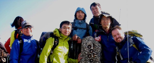
6K5ZLH and I operated on and off until about half past eleven local time to both activate. We were graced by some visits, first DS1RZP, then DS2SHC. We then packed up and headed down to the shelter where HL1KKC and his crew were operating, getting lunch ready, eating or napping in the sun. While down there and catching up on the news, we found out that evidently a hiker who also took to the trail that morning didn’t make it up, having a heart attack on the trail (there are some warning signs at the more popular high peaks outlining the dangers, which are more present at the “must see” destinations that see a much broad range of skill sets attempting the trail). Actually, later on in the afternoon during the descent we saw another rescue helicopter out looking for somebody–not sure it’s increased risk or simply an increased quantity that shows the normal risks that exist at any time.
At one o’clock, after having taken the group shot below, we started our descent, rather, what I thought was to be our descent. Hangyeryeong is a few hundred meters higher up than Osaekyaksu, but the path there is still a good distance. There were a few times when we passed markers indicating our elevation was “currently” 1300 meters–wait, we’re supposed to be coming down from 1700 to 800, when’s it gonna happen? We had quite a few re-ascents right up until the end (I can’t say it wasn’t an interesting trail…some of the views were quite spectacular), then four hundred meters of drop all in the last (less than) two kilometers!
Though ZLH had so graciously offered to truck the 12AH SLAB both up and down, with the 857 and other equipment I was still eager to lose that heavy load, hence my lack of excitement when the reality of the “downhill” came about 😉
At the bottom after a nice cool head rinse, tea and re-hydration spirits were much higher again.
Eventually, everyone made it down (gravity happens) and the fully loaded bus started moving west, only to pause a while later once we got out of the mountains for the obligatory 닭갈비.
As for the rest of the trip, I don’t think much was remembered by anyone, as everybody was sleeping until we got to Seoul, dropped off by Seoul Station at half past midnight…such a late arrival wouldn’t even be enough to stop me from even a mini-activation the next day…
Synchronized SOTA 20110205

The stars aligned on Saturday, or, well, at least the Yagi elements did! There were three SOTA activations going on right around noon time today in HL land–6K5ZLH Wan-seok on HL/GB-001 가야산, HL4GKR Gi-bong on HL/JB-139 오봉산 and I on HL/JB-017 운장산.
Initially, ZLH’s activation was to be solo, and I was organizing our ascent to the summit to coincide with his to get some S2S action (Ji-hun came to tag-along today). Then his schedule moved later, then even later yet when his hiking partner decided to join him. In the end, we were shooting to be on top between 1 & 2 in the afternoon. This worked out nicely, with great weather the whole duration of the hike–sunshine, out of the fog, very light breeze…I only needed a sweater on the summit, and I got my first sunburn of the year. Bravo.
As mentioned before, we were out of the fog, which had been pretty thick both Friday and today in the morning. However, as soon as we reached the top of Pi-am Pass (where the parking lot & trail head are) we were out of the clouds and into the sunshine.
Above we have a view to the westerly mountains poking up and below the view to the north, both panoramas taken on the way up at approximately 800 m asl.
Alas, GKR reached his summit about ten minutes before we did and we had a short chat, then first thing upon reaching the summit I called over to him (he was only 35 km away with an HT) to have my first official QSO of the day. Afterwards, some burritos I brought up were warmed with a leftover MRE warm-up kit, and the yagi set up in the meantime.
With the exception of YOP on his bus running mobile who I have a tendency to lose going through tunnels, all QSOs were at five watts. Signal reports were pretty good as well as the distances, however a nice S2S to HL/GW-001 Seoraksan took the cake for the day with a distance of 260 km, and both of us at 5W! All in all, a much more pleasant activation than the last one in July, in the middle of a cold, windy cloud getting soaked!
6K5ZLH activated his summit and left rather quickly as it was chilly where he was, plus the ascent was four hours and much the same again for the descent. HL4GKR unfortunately didn’t activate, having only the single QSO with me logged, I guess he didn’t get any answers to his CQing on HT–better luck next time…
The big one–Jirisan Cheonwangbong
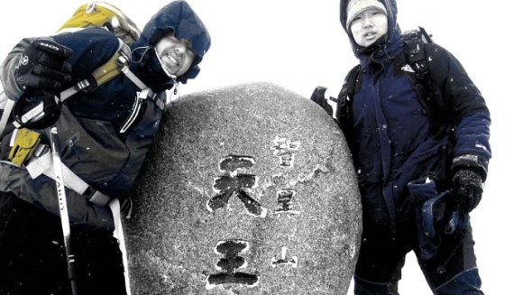
Much to report and oodles of video footage for this winter weekend outing to 지리산 천왕봉 with DS3MBB, DS3OCN, DS3OCO & 6K5ZLH. Stay tuned for more, but at least the summit shot and log for now!
Afternoon outing to Cheonhosan
I got a text around lunch time from 6K5ZLH saying he was going to be up on HL/GB-041 금오산 around three-ish. Not wanting to miss the chaser points, which from his neck of the woods are difficult to come by if I’m not also high up somewhere. So, I decided on going to HL/JB-140 천호산 where I’d previously activated from back in September. It’s not such a haul up to the top, it’s close by and it qualifies for winter bonus points.
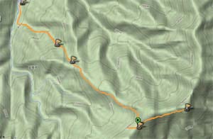
 As you can see from the trail on the right, I have to get through a small pass to get to any of the more convenient trail heads. Funnily enough, as I was putting on the chains to go through, a hiker was coming down my way and informed me it was basically impassible. I tried to get as close as possible–there were tire tracks, but I could only make it so far. Thus I parked at the tunnel construction site and walked the rest of the way up from there. This time I took a different trail up, then descending down the other trail I took previously.

On to the meat: I was primarily trying to have a S2S QSO with 6K5ZLH on his Geumosan activation. It didn’t work–evidently he could hear me but not I him. I was calling with 50 watts and a yagi, he 5 watts and nothing directional or terribly gain-worthy for an antenna…
Alas, I had to move on and get some other contacts. I had some nice DX up into Chungnam making the first contact of the year on DS3LHL’s list and Gyeonggi (Suwon gave me two responses) with also some local contacts. I managed to finish up and break down before sunset, though when I did arrive at the car, it was fully dark. Today I made a better showing than yesterday, though 😉
지리산 만복대 on 20100921
I can finally say “I’ve gone to Jirisan” since I couldn’t really explain why I hadn’t been there yet at least once during my (to date) three year tenure in Korea. I guess I can be comforted by the fact that my hiking companion (only a year or two my junior) had never in her life been to 지리산, and her hometown, Namwon, is at the foot of this hill…ahem.
Also, Manbokdae (JB-006) has already once been activated, earlier this summer, by DS1SED, also on VHF. A nice high summit like this lends itself to VHF activations because of the nice, long distances that are easily attainable on low power. The majority of this activation I was operating on five watts, occasionally upping it to 20W for those tougher contacts and calling CQ.
Though I have to say, I didn’t have to call much on this activation at all–as a matter of fact, the instant I had turned on the rig after setting everything up, guess whose voice I hear? Wan-seok 6K5ZLH! I’ve been trying to log a contact with him during the last two months, not once being successful (a matter of timing and weather, mostly). He lives “on the other side of the hill” but from his city of Gumi, is surrounded by high-pointage peaks. So, I broke into his contact with DS5WEP and subsequently logged my first two contacts.
After these initial two contacts, and the acquisition of ten chaser points grâce à 6K5ZLH who happened to be on Deogyusan‘s main peak Hyangjeokbong JB-002, the regulars were already in line, third up: DS4QBE, followed by DS1SED/4.
As part of the National Parks’ Special Protection Zone program to “give some areas a rest” the particular section we ventured through was “closed.” Luckily enough, it was only the area and the actual trail going through was not off limits, as can happen in other areas and parks. That kind of situation (such is as seen at CN-003 Gyeryongsan) can disable any access to a summit (usually the highest and most popular) and can last for a [very] long time. There are periods with expiry dates on the list that go as far as 2028…
