Korea QRP Club outing

Activating HL/GW-001 설악산 on June 5, 2011 was an endeavor that took about 25 hours. HL1KKC and his Korea QRP club arranged this trip, last time having done it in 2007. After having trucked up to Seoul and meeting 6K5ZLH (who also had to find his way up to the Special City), grilling and eating some porcine flesh on the sidewalk with N5ATY, we took the subway to the other end of Seoul to meet the others at 11 PM and hop on their bus that they had out for the excursion. It was well arranged, we arrived and literally thirty seconds later it was like “here’s your beer, the meat’s on the bus, hop on and grab a seat.”
You’ll note that the departure time was quite late–that being because our hike started quite early: 3 AM. We arrived at the Hangyeryeong Rest Area sometime around 2 o’clock to eat and get ready (this wasn’t our point of departure, rather our final arrival point later on that day). The place was crawling. No place to park, the food stands open and running, the bathrooms steaming, traffic not flowing, really. It was hopping more than those huge pullovers next to eight lanes of traffic at the same time!
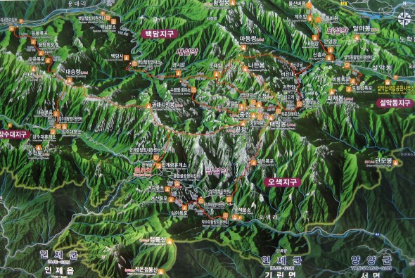
We got back into the bus and started on our descent to O-saek Yaksu (it is lower) twisting and curving along the road until hitting this other “rest area” though not the area proper. There was a good quantity of people milling about, and even though it wasn’t quite three o’clock yet, the trail was open and one could just barely see the lights bobbing up the hill in the trees.
The way up was actually quite normal, just a bit longer (it is a trot up to the top, there!), we took a couple of short breaks on the way up, and upon arriving just below the summit at maybe a quarter to seven, out of the wind and waiting for the rest of the group, HL1WOU already already had a slim jim thrown up into a tree and was making 59 QSOs to Seoul, 140km away with his HT. We had to wait out of the wind, because although we may had been hot at the bottom it was actually quite chilly (very chilly?) up on top!
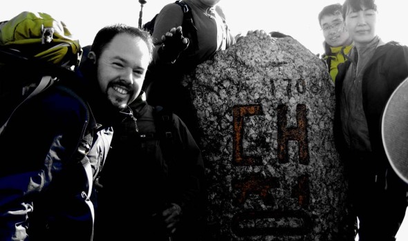
At about ten after seven, we had everybody amassed together again, and set out to brave the crowd on the summit. This is seven AM, not New Year’s morning, and there’s a crowd. On top of Seoraksan, Daecheongbong, there are actually two markers. For each marker there are two lines: one for the photographers, one for the photographees, naturally the two lines advance at the same rate as you have things pre-arranged with your group. Hence the two summit shots above, and not necessarily with everybody coordinated together!
I chose “the sunny side” of the summit to set up initially, it was in fact sunnier, and a bit less breezy. I actually activated from that position, making my first four contacts of the day, including with Mr. SHC who was starting out on his way to that very same summit from a different point down below!
After these first QSOs, we decided to move more over to the westerly side of the summit, finding a rock from which to operate behind, out of the wind, a decent location for the antenna, also.
Much of activation was conducted using five watts, CQing at higher levels to break through people’s squelch at home–however, for those closer contacts that were more tucked into the hills the going was tough even at fifty watts (though almost 300km away to Iksan on five watts brought me a 55 report–that’s with no GP, no Yagi, just a two segment mobile whip!)…
6K5ZLH and I operated on and off until about half past eleven local time to both activate. We were graced by some visits, first DS1RZP, then DS2SHC. We then packed up and headed down to the shelter where HL1KKC and his crew were operating, getting lunch ready, eating or napping in the sun. While down there and catching up on the news, we found out that evidently a hiker who also took to the trail that morning didn’t make it up, having a heart attack on the trail (there are some warning signs at the more popular high peaks outlining the dangers, which are more present at the “must see” destinations that see a much broad range of skill sets attempting the trail). Actually, later on in the afternoon during the descent we saw another rescue helicopter out looking for somebody–not sure it’s increased risk or simply an increased quantity that shows the normal risks that exist at any time.
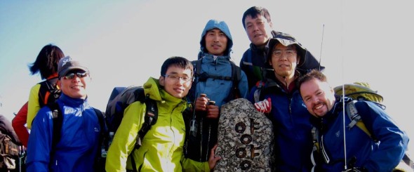
At one o’clock, after having taken the group shot below, we started our descent, rather, what I thought was to be our descent. Hangyeryeong is a few hundred meters higher up than Osaekyaksu, but the path there is still a good distance. There were a few times when we passed markers indicating our elevation was “currently” 1300 meters–wait, we’re supposed to be coming down from 1700 to 800, when’s it gonna happen? We had quite a few re-ascents right up until the end (I can’t say it wasn’t an interesting trail…some of the views were quite spectacular), then four hundred meters of drop all in the last (less than) two kilometers!
Though ZLH had so graciously offered to truck the 12AH SLAB both up and down, with the 857 and other equipment I was still eager to lose that heavy load, hence my lack of excitement when the reality of the “downhill” came about 😉
At the bottom after a nice cool head rinse, tea and re-hydration spirits were much higher again.
Eventually, everyone made it down (gravity happens) and the fully loaded bus started moving west, only to pause a while later once we got out of the mountains for the obligatory 닭갈비.
As for the rest of the trip, I don’t think much was remembered by anyone, as everybody was sleeping until we got to Seoul, dropped off by Seoul Station at half past midnight…such a late arrival wouldn’t even be enough to stop me from even a mini-activation the next day…
Circling Seoul: Twofer one
So then, at the last minute we planned a day trip up to Seoul for this second weekend of February: the XYL would do some foreign food supplies shopping and I would hopefully meet up with a friend or another and hit a summit not yet hit.
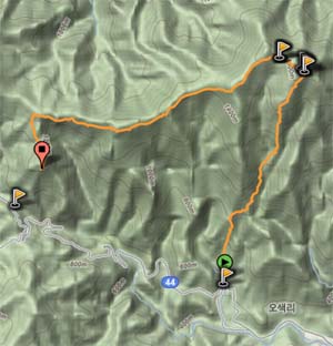
Well, it seemed all possible peeps who could have maybe accompanied were either busy or out of commission, as unfortunate as that sounds, it allowed me to push my limits a bit and try to tackle two summits while out this time. For the occasion I chose HL/GG-044 수락산 and neighboring HL/GG-084 불암산, both two pointers and qualifying for winter bonus. I was thinking of HL/SL-001 도봉산, which has been on my to-do list for a while but was hesitant with the temperature not wanting to dilly-dally too much on that summit to scrape up contacts since from the standpoint of the city, it’s in the “shadow” of HL/GG-015 북한산 a bit…
Saturday morning we hopped on the first bus out of Iksan at 5:30 rolling into Seoul around 8–we grabbed a quick breakfast then went our separate ways, there are a few trail heads I could start at and I chose the one ascending from Jangam Station which passes by 석림사 temple. It took almost an hour to get to that point, so started my walk at about quarter after ten.

After leaving 장암역 and passing through the small neighborhood across the street host to many temptations but not limited to steamed corn and 닭발, as well as basically “last chance for eisen or turn back” stands if you forgot yours.
Next on the tour is 노강서원 Academy followed by 석림산 Temple itself, where you can see this very statue on the left.
This is the point where the trail actually starts and you leave concrete. For this portion, it runs along the southern side of the valley (the north facing slope) which means it was actually quite slippery, there had been enough thaw to have some water flow outside the stream on the banks then refreeze, so extra caution was needed. As a matter of fact, there was an ice-climbing/ice ax lesson underway in the middle of the frozen stream–being conducted in English which I thought to be very interesting. After a while and the trail reverting back to the other side of the stream, the trail condition improved very much.

Now, I arrived at the summit at exactly noon, and it was fairly crowded, with many people having come up from other trails. An appropriate spot was scouted out after the obligatory stele shot, exposed yet out of the wind (there was almost a nest-like depression in the rock) and out of the way.
For both of the activations today I didn’t spot myself, instead relying on the population to support my cq calls–and for this first hour basically had a steady stream of contacts without having to revert much at all to the main calling channel, but switching once to the HL9 calling channel at 145.6 to dip my toes in that stream and have a QSO in English (weird!) 😉
At 1:30 (when I realized what time it was) I packed up quickly to get along to my next goal of the day, with the day’s supper appointment later on in mind. As I was weaving between the many rocks on top of this hill (they’re huge!) I started talking to the members of the 건실회 hiking club as I was taking a panorama photo of said rocks. We had a few laughs, took a few photos, then started heading down, later splitting paths as they descended and I continued along the ridge towards Bulamsan.

Continuing along the ridge with a gentle descent was pleasant enough, until I came to a fork where some others were coming up from the wrong way, I inquired as to which direction for my goal with them responding to go down their trail–well, Alice, it wasn’t the right one, but it did lead down to Heungguk-sa Temple with an impressive collection of statues. I then reascended and continued along the correct route, over the pass road and up 불암산.

Of course, this story wouldn’t be complete with something rolling down hill, so, on my way up to this summit I had paused for a snack (MRE “snack bread” in fact, a modern day “pilot biscuit”) and washing it down with some caffè corretto. However, as I stood up to move along, did I hear the metallic contact with rock as the thermos slipped out of the still open back pocket and down the path. Luckily there weren’t any human targets in its path, and I didn’t have to mosey too far down to fetch it.
Now the ascent from the northern slope of this summit can please or displease you depending on your personality, circumstance or time allotment. It was four o’clock as I crossed over the pass, with an hour of climb time, and then an hour and a half before sunset. This is one of those multi-bong climbs, where you think you’re reaching the summit and it turns out to be a minor summit, you go to the next and alas, it’s just another bong, and so on and so forth. When you’re watching the clock it isn’t the most pleasant surprise.
Finally, got to the last one, up the stairs to the pile of rocks on top and found a nice crevice where I could operate from out of the wind and have the antenna mounted higher up and exposed. I made it a point to make this activation short due to the light situation, rapidly got five contacts, packed up and re-descended. Below this major summit was a 막걸리 tent and as there were multiple routes and even two that go to two subway stops I asked about which stop to head towards, Danggogae or Janggye, with another person there who had just asked the same thing. Janggye was it so there was no hesitation as we [very] quickly departed.
Going down on the west side was much more convenient with no ice at all on the trail (sun exposure) and we had a chance to witness the sunset upon Bukhansan. We chatted along the way down but I had to forgo the 막걸리 at the bottom as it was already almost seven with another hour of subway ahead of me before I could even consider dinner 😦 but it was quite enjoyable. Next time, definitely. 73–


